
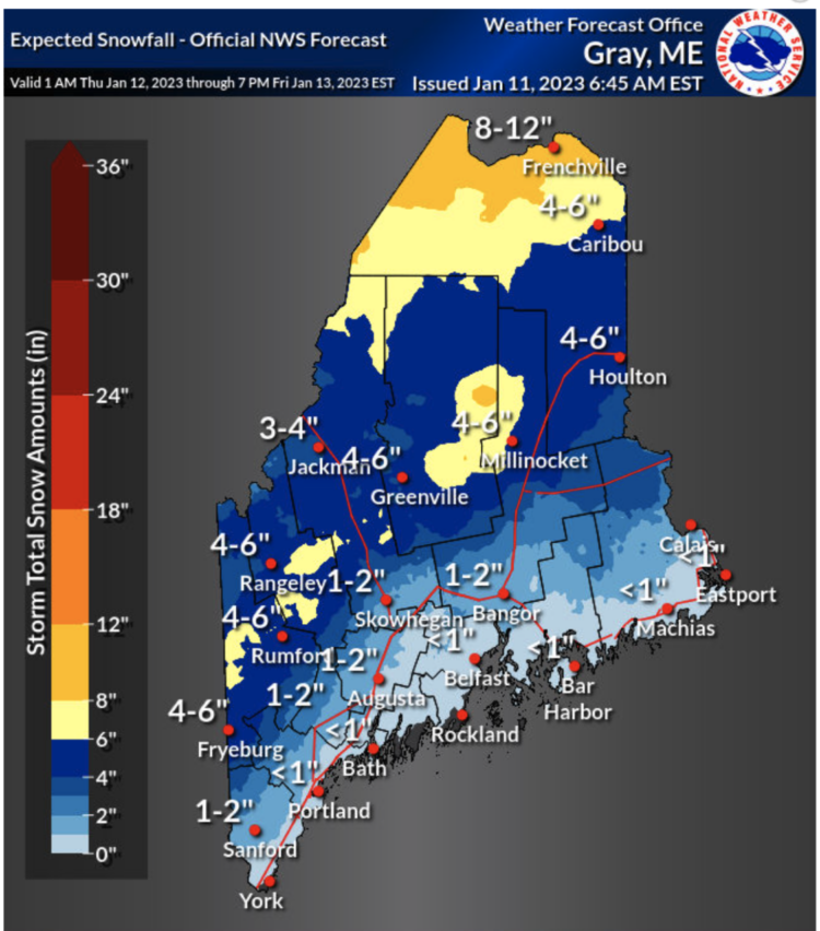
The next storm arrives midday tomorrow and will start off as snow, but quickly change over to rain along the coastline.
However, there will be several inches of accumulation in the western and northern mountains before transitioning to rain.
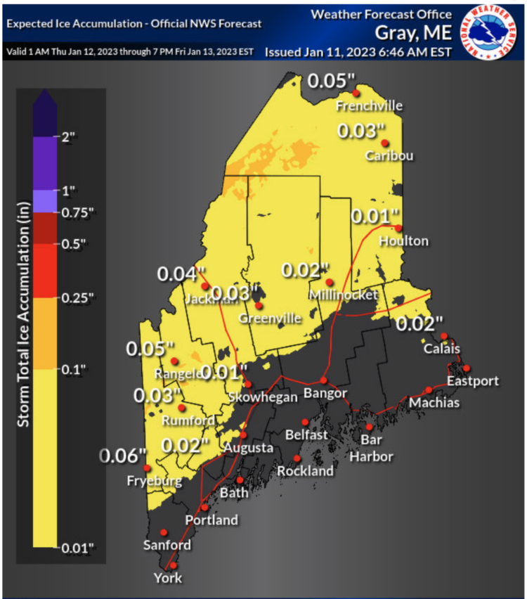
Of note is a light icing from this storm when you get further away from the coast. I do not expect any power outages, but be prepared for some slick travel Thursday into Friday.
I don’t expect all of the snow to be washed away in the higher elevations. The snow depth map shows several inches of snow remaining for western and northern Maine this weekend. That’s good news for ski resorts and winter sports.
For those wondering if this unusual start to winter is having any impact on the drought, there is no need to worry yet. The latest drought monitor for Maine shows the entire state is drought-free.
More than one inch of total precipitation is expected when the storm is all said and done statewide by Saturday.
Comments are not available on this story. Read more about why we allow commenting on some stories and not on others.
We believe it's important to offer commenting on certain stories as a benefit to our readers. At its best, our comments sections can be a productive platform for readers to engage with our journalism, offer thoughts on coverage and issues, and drive conversation in a respectful, solutions-based way. It's a form of open discourse that can be useful to our community, public officials, journalists and others.
We do not enable comments on everything — exceptions include most crime stories, and coverage involving personal tragedy or sensitive issues that invite personal attacks instead of thoughtful discussion.
You can read more here about our commenting policy and terms of use. More information is also found on our FAQs.
Show less