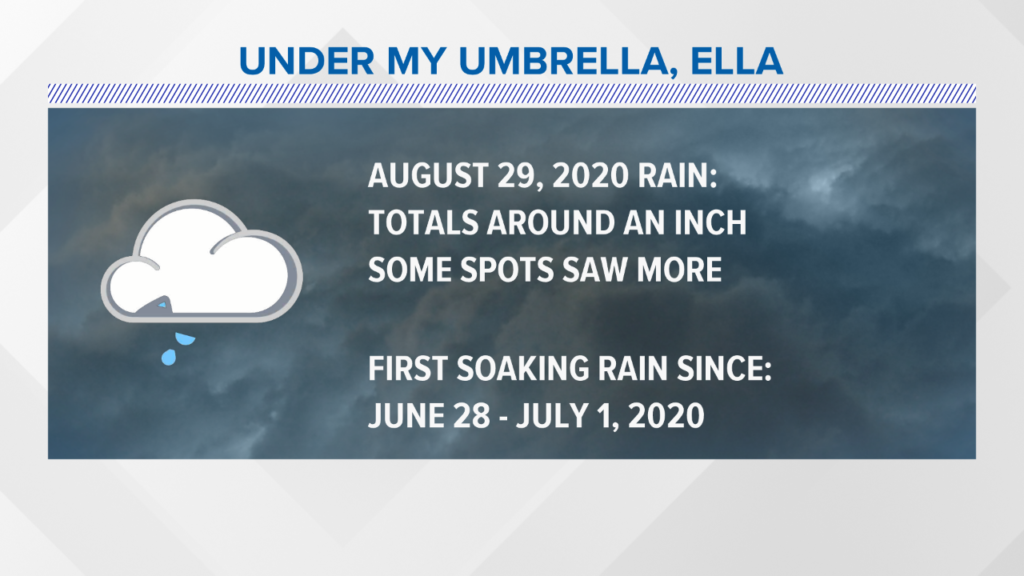
Much needed rain led to pretty gloomy conditions Saturday, but it’s a small price to pay for the upcoming week. This was actually the first soaking rain event in almost 2 months.
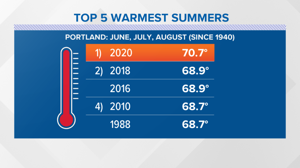
Before the forecast, I’d like to take a retrospective look at this past summer. In the world of meteorology, we measure summer as June through August. In Portland, 2020 is likely going to rank as the warmest summer on record. The average temperature was above 70 degrees, so this includes both daytime high temperatures and overnight low temperatures. The top three warmest summers in Portland have occurred within the last 5 years.
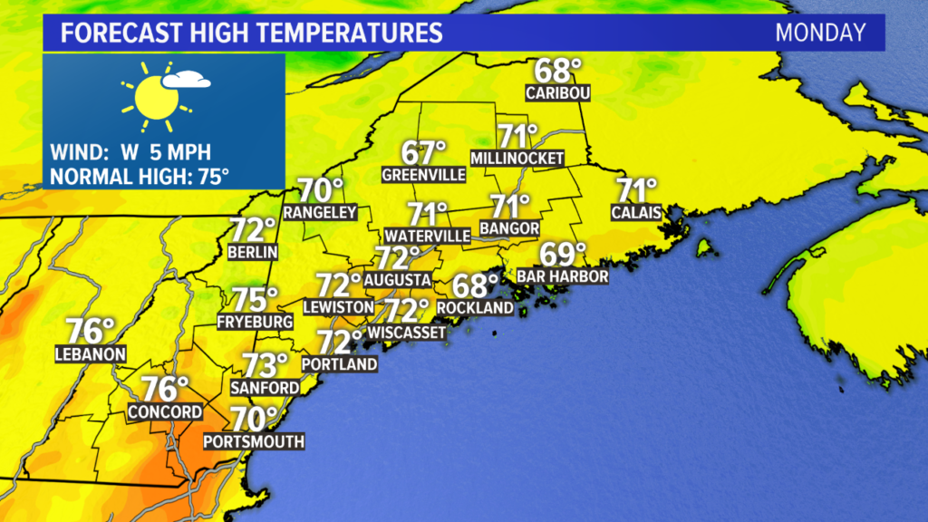
Back to the forecast! Monday could be one of the nicest weather days we have seen in 2020, and is in the running for a top 10 day for the year. Mostly sunny skies with high temperatures in the low 70s will be prevalent statewide. The breeze will be light, too. Some transient high clouds are expected but sunshine will be dominant.
Clouds return Tuesday, but the day still looks dry. Expect a cooler day, with coastal highs in the low 70s and inland areas on either side of 70 degrees. While not as sunny as Monday, it still qualifies as fairly nice – especially since humidity remains low.

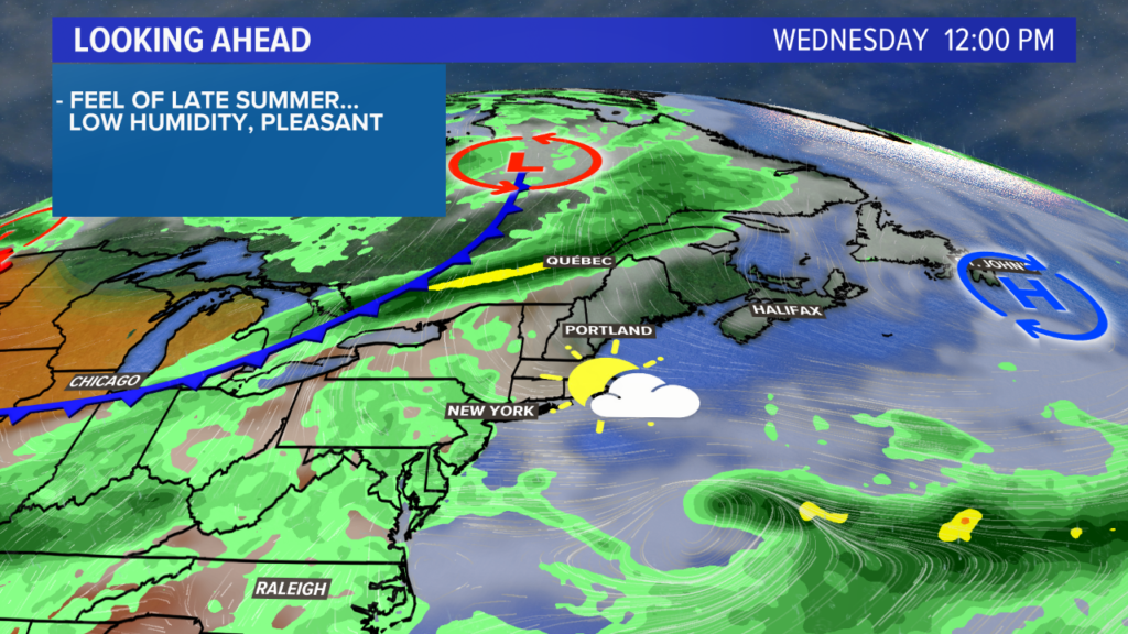
The front stays north on Wednesday. Originally, it looked like an active day locally. However, the forecast continues to trend drier. It will be another day of sun and clouds with high temperatures in the low 70s.
Afternoon showers and storms return Thursday as another system rolls through. It looks like showers could be widespread through the evening. A few showers may even linger into the morning on Friday.
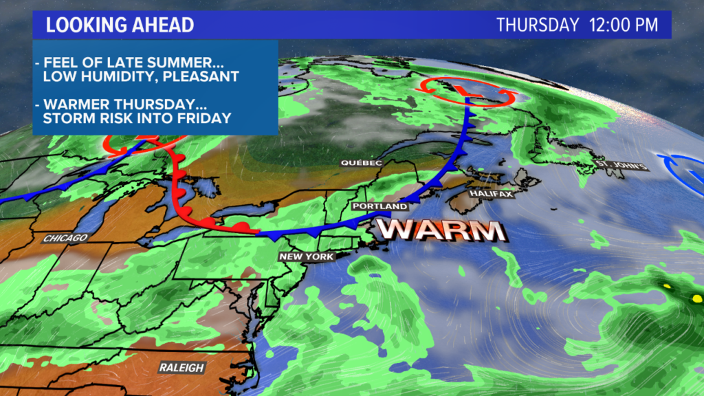
Labor Day weekend is shaping up to be spectacular, though. More details as we get closer.
Check out my Twitter and Facebook pages for more local weather information.
Comments are not available on this story. Read more about why we allow commenting on some stories and not on others.
We believe it's important to offer commenting on certain stories as a benefit to our readers. At its best, our comments sections can be a productive platform for readers to engage with our journalism, offer thoughts on coverage and issues, and drive conversation in a respectful, solutions-based way. It's a form of open discourse that can be useful to our community, public officials, journalists and others.
We do not enable comments on everything — exceptions include most crime stories, and coverage involving personal tragedy or sensitive issues that invite personal attacks instead of thoughtful discussion.
You can read more here about our commenting policy and terms of use. More information is also found on our FAQs.
Show less