Monday is going to be the coolest, rainiest day in Maine in quite some time. It’s all thanks to an upper level low that spins over us for most of the week. This will dictate our weather for most of the week, though Monday looks the wettest.
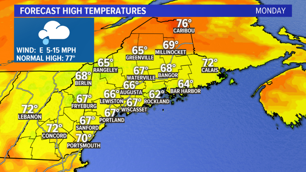
Did I mention it’s going to be chilly Monday? We’ve been spoiled with a seemingly unending supply of beach days in the 80s. Not the case this week…some spots on Monday afternoon will not even make it past 70 degrees.
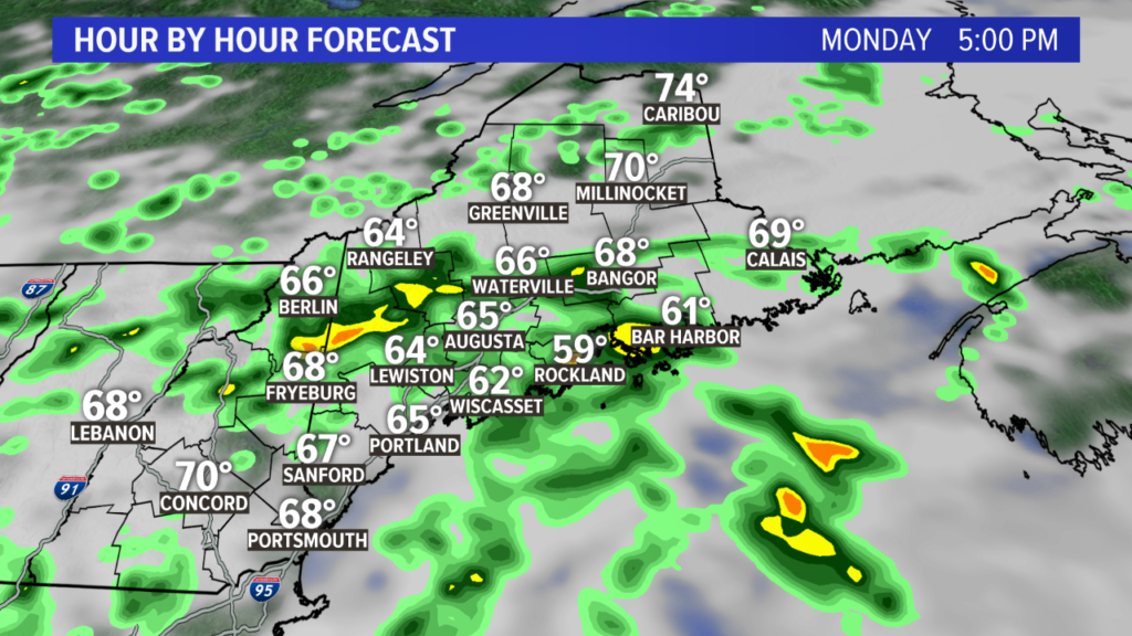
Showers become more widespread Monday afternoon, with few weaker thunderstorms embedded here and there. Severe weather looks unlikely.
Some fog is possible again heading into Tuesday morning, especially at the coastline.
No matter what, Tuesday will be a cloudy day with passing showers and a few rumbles of Thunder. That upper low is going to just sit and spin, right over us.
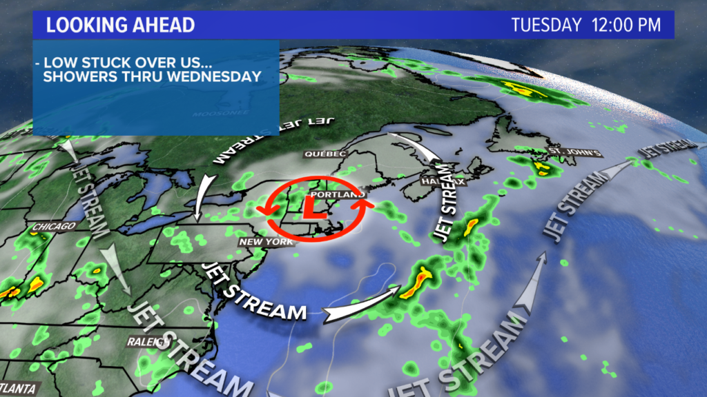
Highs on Tuesday return to the 70s.
By Wednesday, a drier morning is in store. This means a bit of sunshine! By the early afternoon, though, the sunshine will fuel another round of showers and storms. Again, severe weather seems unlikely, but there will be more thunder around than the previous days.
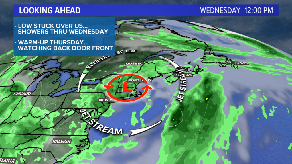
The low finally scoots east Thursday, pumping the heat and humidity back to Maine. Highs on Thursday reach the 80s just about everywhere, with a few 90s mixed in through some of inland hot spots.
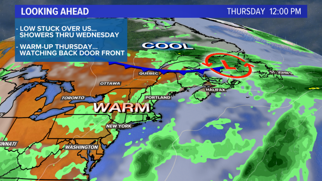
A backdoor front Thursday will be the focal point of showers and storms. The result? A high near 70 on Friday with full sunshine, followed up by a 75 degree, sunny day for the Fourth of July. Pretty peachy weather, and perfect to spend the evening by the grill.
For the latest forecast information and/or pictures of my corgi in all her glory, follow me on Twitter and Facebook.
You must be logged in to post a comment.