
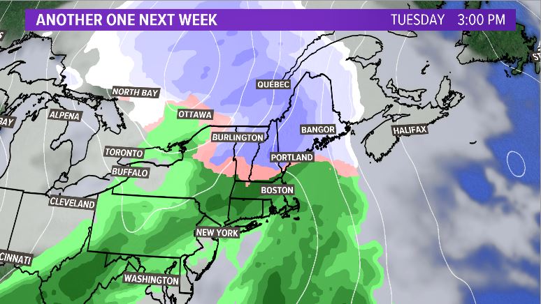
Another wave of energy rolls through this week to impact the commute for Mainers.
For the last few weeks, the storms that have rolled through have been short-lived events accompanied by 36 to 48 hours of Arctic cold.
SNOW CHANCES:
Snow showers start up in western Maine right around noon Tuesday. The first flakes fall in the mountains.
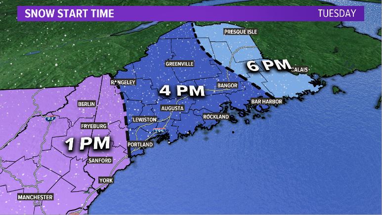
As the clock rolls forward into the middle of the afternoon, snow showers overspread the state of Maine.
Snow will likely accumulate on most surfaces, including roadways, through the afternoon and evening.
Slick roads are a concern for the Tuesday evening commute. Although snowfall rates do not look super impressive, expect reduced visibility as the snow comes down.
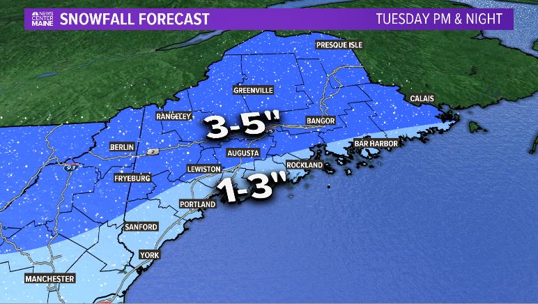
As the storm pivots off the coast of Maine, warmer air sneaks in for a transition to rain along the coastline. There will likely be just a bit of mixing on a line from Sebago to Lewiston to Bangor to Eastport.
South of this line, expect 1 to 3 inches of snow with a transition to rain.
North of this line, totals look more like 3 to 5 inches. There could be a couple of higher totals near Fryeburg or Brownfield, but totals over 6 inches are still unlikely.
The storm wraps up by sunrise Wednesday, ushering in colder air through the day. Other than isolated slick spots Wednesday morning, conditions will improve quickly for the rest of the day.

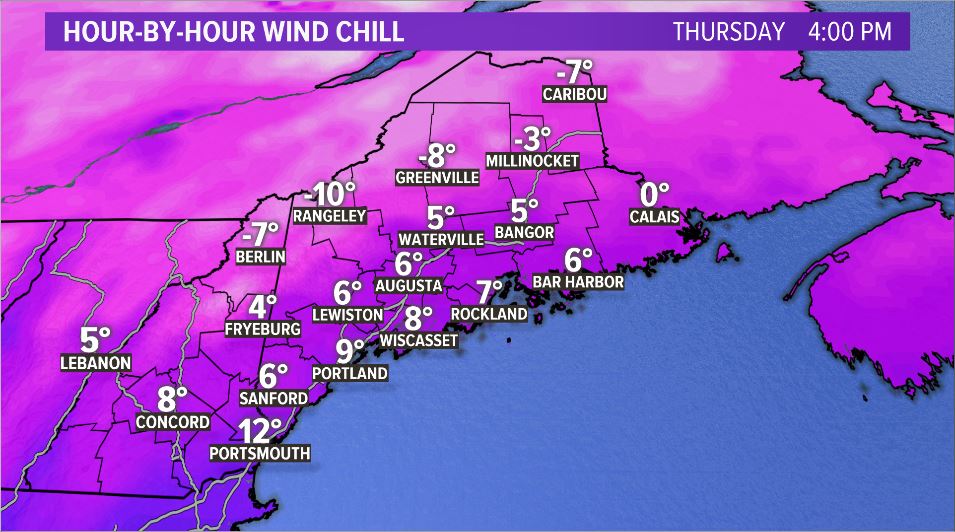
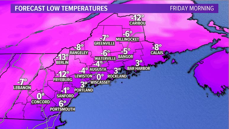
QUICK COLD SNAP:
It seems like we’ve kept things pretty toasty this winter. There has not been a very long cold stretch recorded since the winter started. In fact, the number of mornings below zero has been much lower than average in Portland, Augusta, Bangor and Caribou.

I think we’ll see at least a couple of these areas add another morning below zero on Friday.
Again, this is not long-lived cold. Still, expect blustery conditions on Thursday with one of our coldest mornings this season on Friday.
By Saturday, sunshine is back with plenty of warmth to go around. The pattern looks quiet heading into the weekend, too.
For the latest forecast information, follow me, Mike Slifer, on Twitter and Facebook.
Comments are not available on this story. Read more about why we allow commenting on some stories and not on others.
We believe it's important to offer commenting on certain stories as a benefit to our readers. At its best, our comments sections can be a productive platform for readers to engage with our journalism, offer thoughts on coverage and issues, and drive conversation in a respectful, solutions-based way. It's a form of open discourse that can be useful to our community, public officials, journalists and others.
We do not enable comments on everything — exceptions include most crime stories, and coverage involving personal tragedy or sensitive issues that invite personal attacks instead of thoughtful discussion.
You can read more here about our commenting policy and terms of use. More information is also found on our FAQs.
Show less