
Alice Larrea had a vision.
In the late 1990s, the former Cape Elizabeth resident donated more than 70 acres by Sawyer Road to the town. She stipulated that it be used for passive recreation such as bird-watching, hiking and nature observation, and could not be used for activities such as organized sports.
In honor of her family, this area of land is now known as Winnick Woods.
Thursday, a ribbon-cutting ceremony will mark the culmination of the work to fulfill Larrea’s vision for the property, and the Conservation Commission’s years of planning and development. The event begins at 5:30 p.m., at the entrance of the property on Sawyer Road. Town officials and Conservation Commmittee members will attend, as well as Larrea, accompanied by her father.
“All trails are the result of volunteer labor, said Maureen O’Meara, town planner. “Visitors should be respectful of this and the natural beauty of the land and always leave it the way they find it.”
Cape’s Conservation Commission incorporated this property into the Greenbelt Plan in 2001. The vision statement of that plan was “to establish a town-wide network of trails by connecting the town center to important open spaces and all neighborhoods through a hub and spoke system.” Of the 21 trail links identified in the plan, Winnick Woods was designated as one of the top five for development.
A master plan was developed by the commission and adopted by the Town Council in 2006. The plan successfully balanced the need to protect the sensitive wetlands and wildlife habitats on the property, along with the need for public access and use. It also accommodated Larrea’s wishes that all activities on the property remain harmonious with the natural beauty of the land. Both of these plans won Plan of the Year from the Maine Association of Planners.
A revamped stone shed, located on Sawyer Road, will mark the trailhead of the area and serve as an information kiosk, and there will be a small parking area. Visitors can enter here, and enjoy the many well-marked walking trails that were created by the Conservation Commission to complement the trails that already existed. The commission also worked with about 20 volunteers to construct bridges and boardwalks to make the trails easier to navigate.
These trails extend from the trailhead south, and will bring visitors through wetlands, meadows and wooded landscapes. Eventually, these trails will link to the existing trails of the surrounding conservation areas of Dyer-Hutchinson and Cross Hill. All the additions and alterations made by the commission are non-invasive and in keeping with the natural beauty of the area.
In addition to the development of this property for public use, the Conservation Commission will continue to maintain and landscape certain areas of the woods to prevent it from becoming dense forest. A primary goal is to partner with the U.S Fish and Wildlife Service to maintain a viable habitat for the New England cottontail. Identified as a declining species, the cottontail needs dense shrub to avoid its predators. If land is left untouched, it reverts to the woodland stage, thereby eliminating the shrub cover this animal needs to survive.
Along with the efforts of the Conservation Commission, the project was helped by the work of volunteers, the 2007 eighth-grade community project students and the town’s Public Works Department. Volunteers included a group of about 20, who assisted in building bridges, as well as town resident Nate Murray, who spread woodchips along the trails while riding his ATV.
The students consisted of three classes of 20 to 25, who cleaned up and collected brush. The Public Works Department was instrumental in clearing many areas, as well as removing the brush collected by the students.
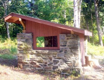 Winnick Woods, once a vision, now reality
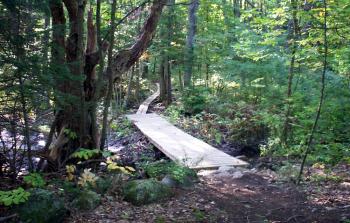 Winnick Woods, once a vision, now reality
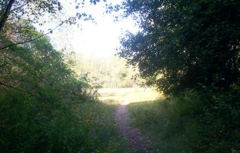 Winnick Woods, once a vision, now reality
Comments are no longer available on this story