Thursday’s storm will be big in both size and strength. While snow will be heavy and intense, don’t overlook the wind –it’s an important aspect of this storm.
Snow will begin in central and southern Maine between 6 and 9 a.m. Thursday, and will spread north between 9 a.m. and noon.
We’re not in the business of predicting school closures, but this looks like a case where many will opt to close for the day.
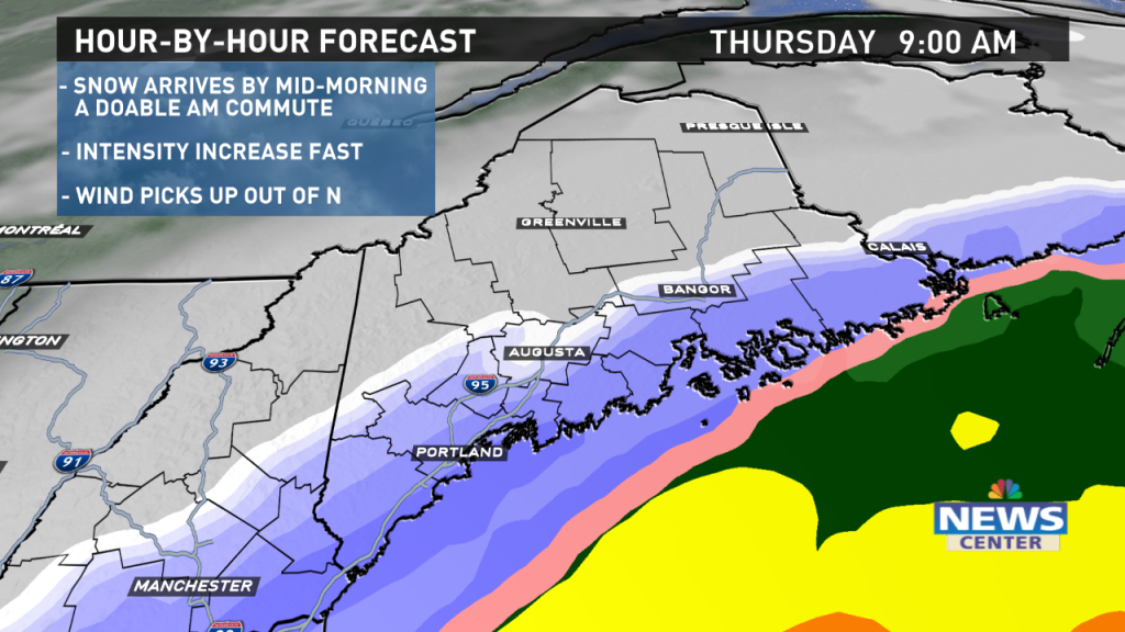
The intensity will increase fast. While the morning commute should be doable in most places, conditions will quickly deteriorate on the roads from late morning until lunchtime.
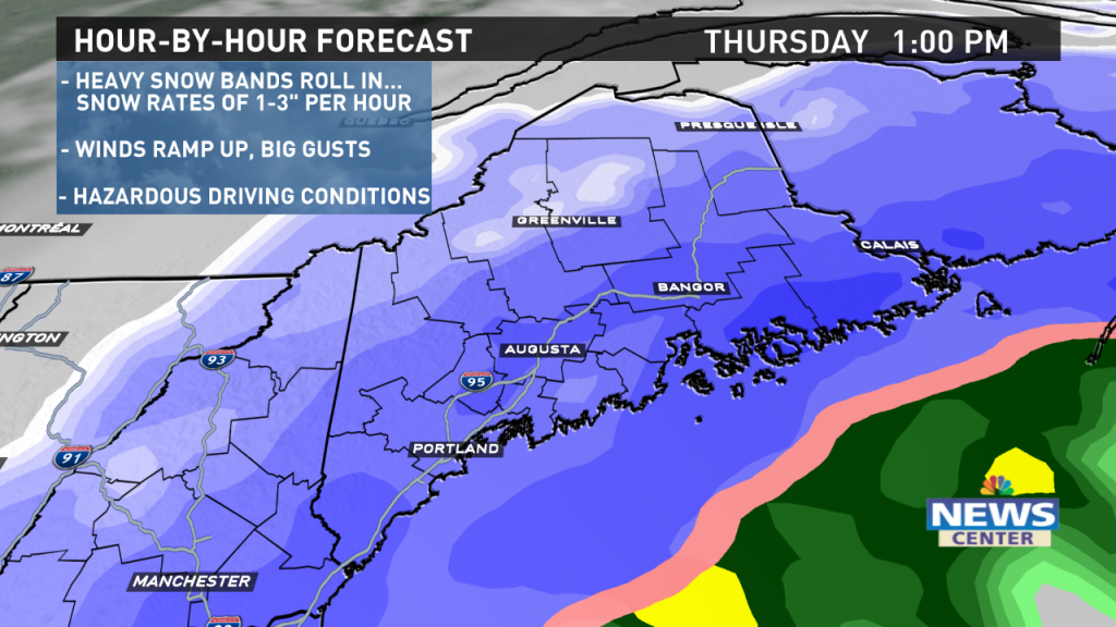
The heaviest snow will fall from midday into the early evening. Snow will fall at the rate of 1 to 3 inches per hour in the heaviest bands.
Strong wind gusts will coincide with the heaviest snow, creating blizzard conditions and making roads difficult for travel.
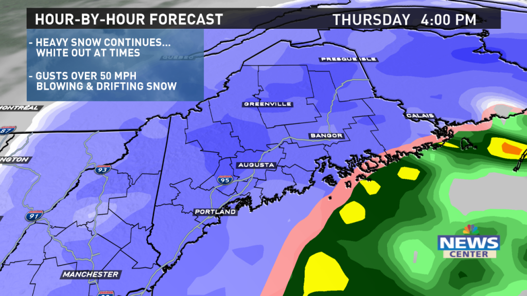
The steady snow will come to an end Thursday night. Lingering snow showers are expected Friday.
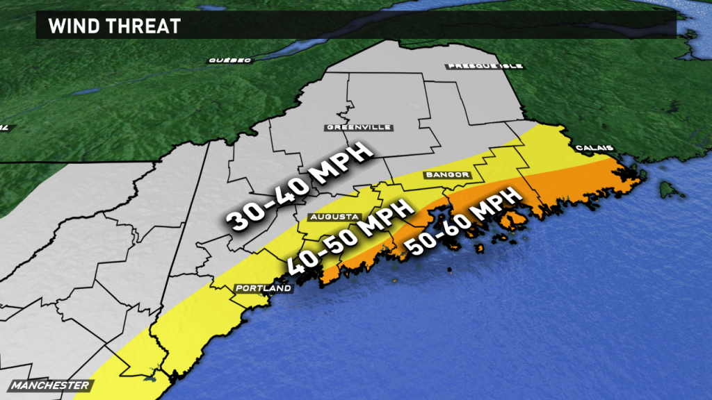
Power outages are a concern. The strongest winds will be along the coast and in high elevations, where gusts over 50 mph are expected. Midcoast and Down East are most susceptible to peak gusts around 60 mph.
While it won’t be anything like the wind storm back in October, some outages are going to occur. Have a plan in place, just in case. Please, ventilate alternate heating sources well. Run generators outside. Know where your local shelter is, too.
Behind the storm, another blast of arctic air moves in for the weekend. Cold records will be challenged or broken Saturday, with lows well below zero and highs only in the single digits.
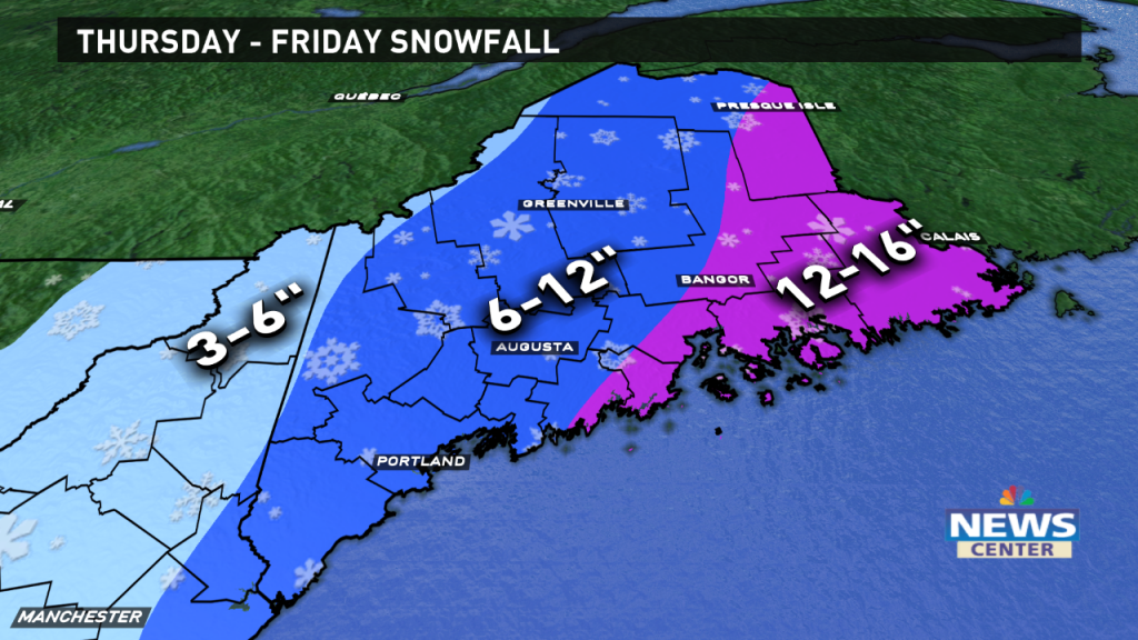
Snow totals will be in the double digits for many. The highest amounts are expected near the coast and in eastern Maine. Some towns could approach a foot and a half.
Follow updates from the News Center Maine weather team on-air and online throughout the storm.
Ryan Breton
Follow me on Twitter and Facebook @RyanBretonWX.
Comments are no longer available on this story