

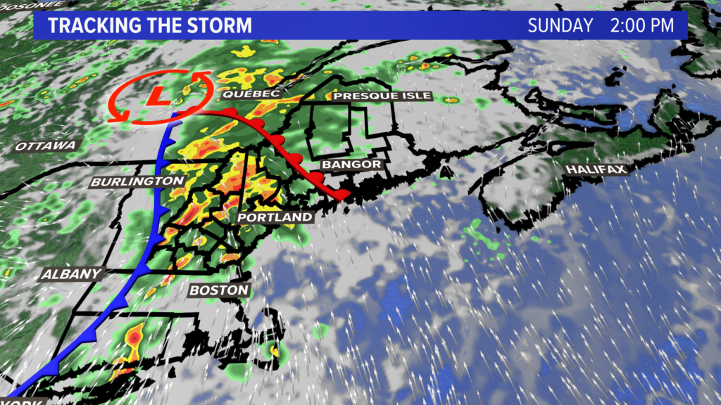
The latest forecast calls for a slow-moving cold front to approach from the southwest Sunday. This front will slow to a crawl and allow deep, tropical moisture to be pulled up from the south. Heavy rain – potentially 2 inches or more per hour – will hit thanks to the thunderstorms Sunday.
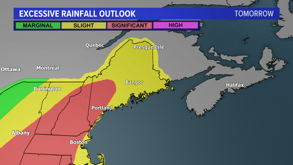
The National Weather Service has issued a “significant” excessive rainfall outlook for western and southern Maine, along with nearly all of New Hampshire, on Sunday. This means rainfall will cause flooding when the heavy rain hits the already-saturated ground.
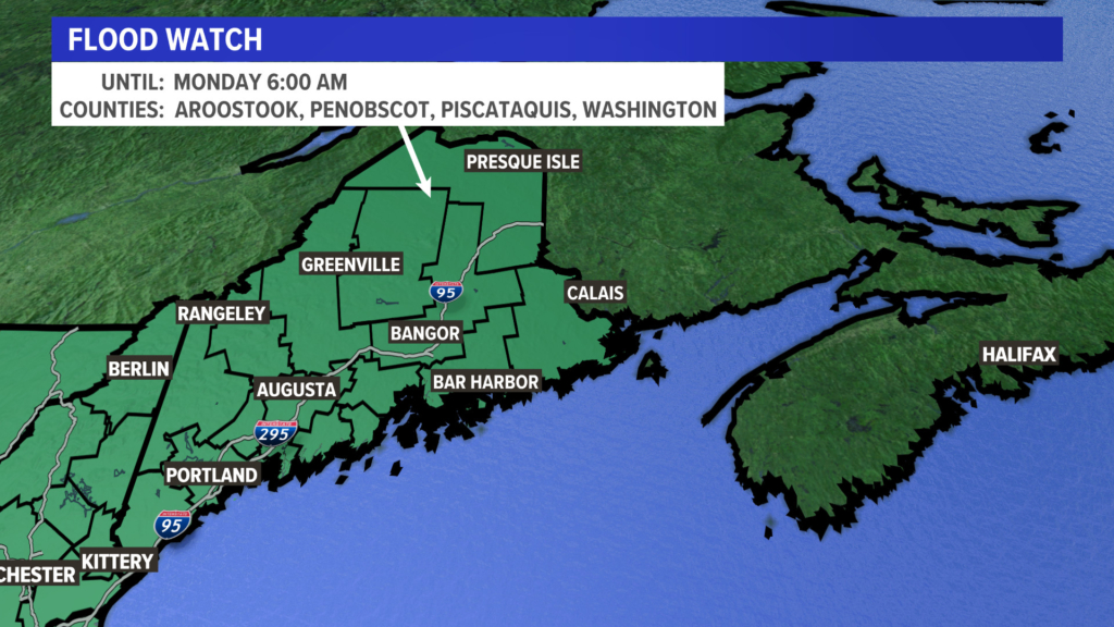
That’s why there is a flood watch up for all of New Hampshire and Maine on Sunday into early Monday.
The favored upslope areas of the foothills in Maine’s western mountains is where there is potential for significant flooding. Same goes for the White Mountains of New Hampshire.
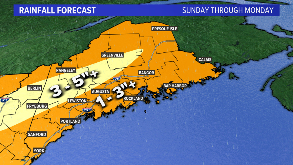
Be prepared to head to higher ground Sunday to Monday, no matter where you are in Maine or New Hampshire. Water can sweep you or your car away very quickly.
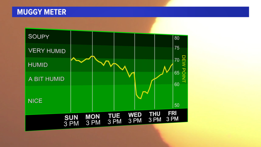
Another cold front moves through the region Tuesday into Wednesday and will bring a brief break from the high dewpoints.
Send questions/comments to the editors.

Modify your username
Please sign into your Press Herald account to participate in conversations below. If you do not have an account, you can register or subscribe.