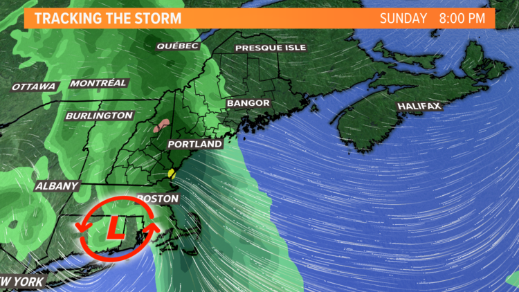
The weather is featuring a blocking pattern this weekend into early next week. Think of it like a storm riding smoothly on the weather highway (jetstream) until it hits traffic on I-95 in Maine and slows to a crawl. That’s what will happen Sunday into early next week as low pressure develops over southern New England and slows down over Maine.

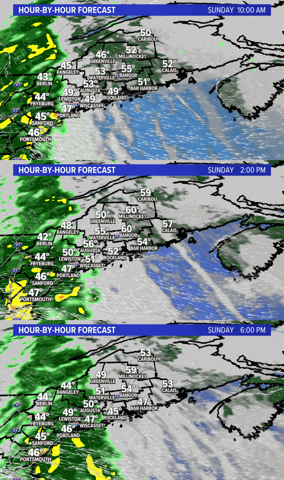
Rain will begin in New Hampshire early Sunday morning and spread into Maine after daybreak.
The rain will be heavy at times for southern Maine in the mid- to late-morning Sunday, but it will be dry for central, northern and Downeast Maine.
A strong easterly breeze will keep temperatures in the 40s for southern Maine, while it will be warmer with sunshine over eastern parts of the state before the rain arrives.
Low pressure moving over southern New England will be very slow to make any progress north, and due to the placement of the low, our wind will come off the ocean.

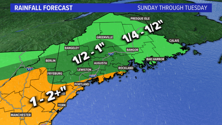
The persistent rain will lead to minor flooding in small streams. Up to 2 inches or more of rainfall is expected for parts of southern Maine.

There will only be snow at the highest peaks of Maine and New Hampshire with this storm.

Here’s a look at how much snow you can expect:

The storm will start to pull away as the “traffic” on the weather highway lessens by Tuesday. However, there will still be on-and-off showers continuing into the middle of next week.

Comments are no longer available on this story