We knew it was too good to be true. Winter is not done with us yet, and a powerful March storm will bring wintry precipitation to the state early to the middle of next week.

Heavy, wet snow will begin Monday night before changing over to rain along the coastline.
The snow will stay heavy and won’t be as wet in the higher terrain through Tuesday.

Who gets the most snow will depend on the rain-snow line and how much it moves, with most of the precipitation coming Tuesday.

Here’s what I know at this point:
Along the coast a few to several inches of snow will fall before the changeover. Double-digit jackpot potential is likely away from the coast in the Oxford Hills to the western mountains.
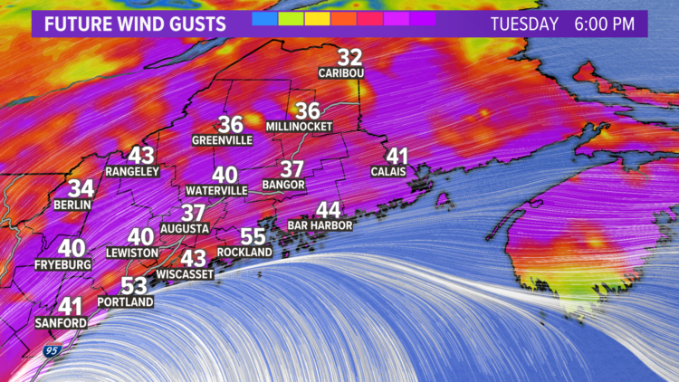
Power outages are a threat due to the heavy, wet snow and high winds.

This nor’easter will hang around for 3 high tide cycles and seas will peak on Tuesday along the coast.

Comments are no longer available on this story