We’ve enjoyed record warmth and clear roads for far too long by February standards in Maine. It’s time to get back to typical winter weather, right?
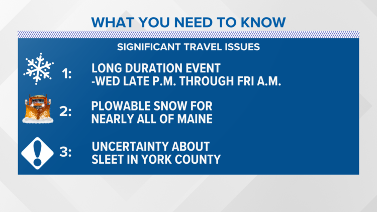
The spring preview in Maine is about to come to a grinding halt as Old Man Winter sets up shop Wednesday night through Friday morning in a long duration winter storm. Winter storm watches have already been posted and I expect those to be upgraded to warnings soon.
Here’s what you need to know:
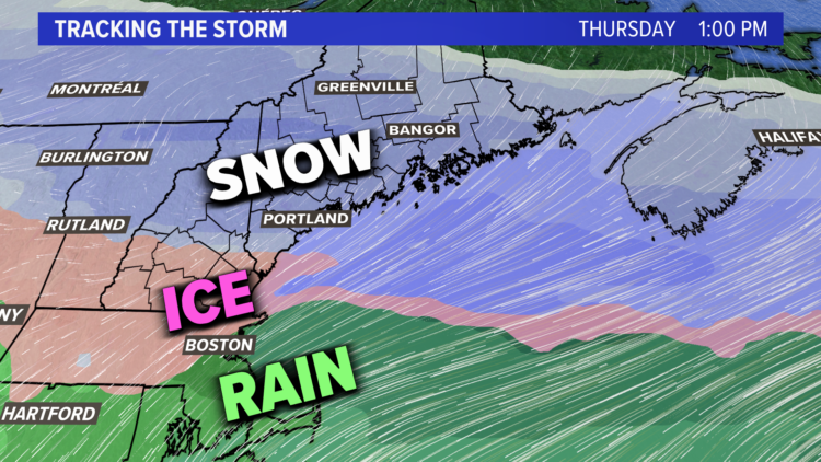
There will be significant travel issues on the Thursday morning commute with heavy, wet snow falling from the Midcoast to the southern coast.
There will also be heavy sleet for southern York County, and that’s where I expect snow totals to be much less. The snow will be fluffier and lighter as you head north, but there will also be a sharp cutoff in precipitation the farther north you go. I don’t expect any snow in The County until late Thursday with another wave of moisture moving in.
Here is when I expect the snow to start across New Hampshire and Maine:
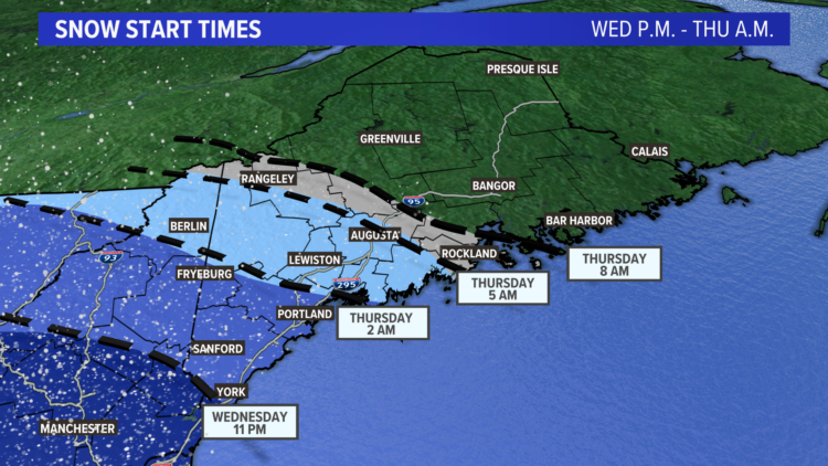
The hour-by-hour forecast features the snow being heaviest in the morning on Thursday with lighter snow for the afternoon and evening. Round 2 will get here late on Thursday into early Friday.
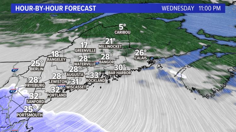
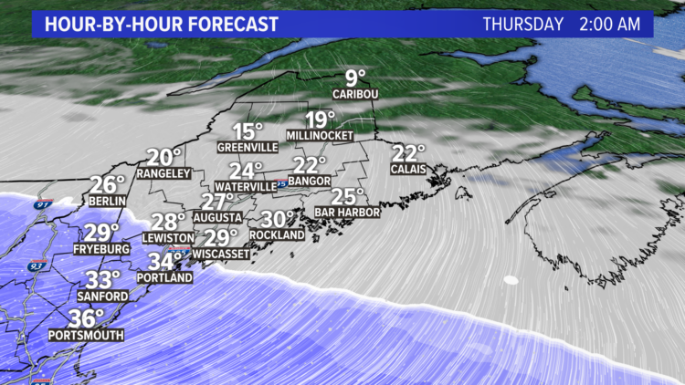
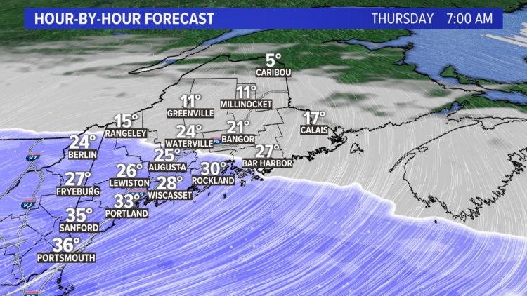
When it’s all over on Friday morning here’s how much snow you can expect:
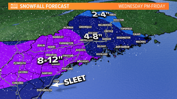
Take note that I am uncertain how much snow can accumulate with sleet in southern York County due to a warm nose of air melting the snow higher in the atmosphere. It is possible we don’t get to the 8-inch mark for places like York, Kittery, Ogunquit, Wells, etc.
It remains to be seen if we get enough snow to rival some of the biggest storms in recent history. Portland has a chance of getting up to a foot.
Either way, the coast of Maine that’s in a snow drought with nothing but grass on the ground is about to get a big change very soon. The forecast continues to change and new data is coming in.
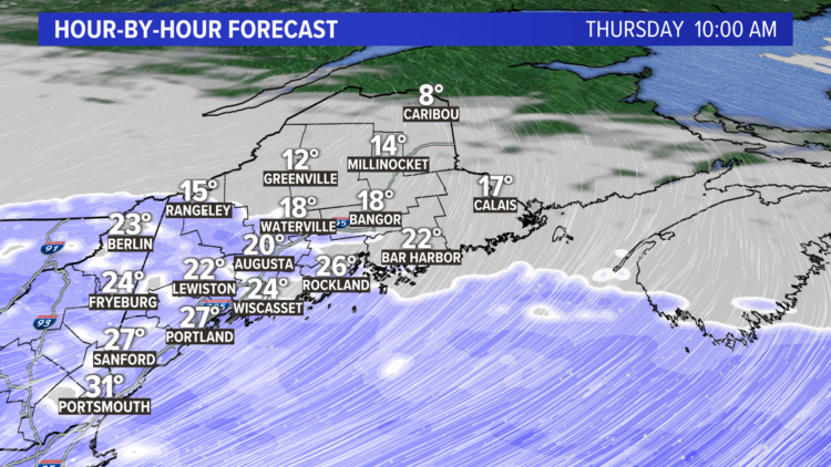
Comments are no longer available on this story