We have waited a long time for this…a storm that will bring drought relief to places that need it most in Maine.
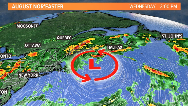
A rare August nor’easter will begin to take shape as low pressure deepens as it moves into the Gulf of Maine on Wednesday.
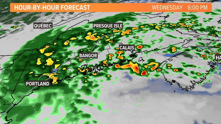
Rain bands will start moving into Maine from east to west, some of them heavy at times.

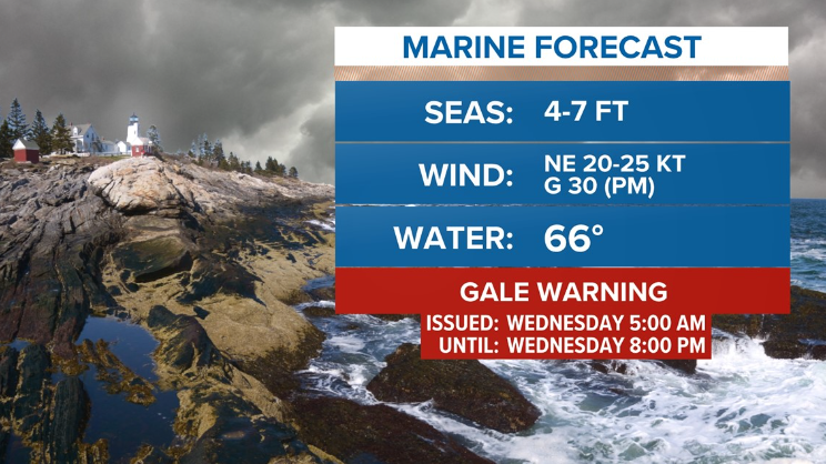
High surf advisories and gale warnings are up for the southern coast, as well as a rare summertime gale warning.
Look for large breaking waves about 5 to 8 feet tall in York County.
Check the Kennebunk Beach camera on Wednesday to see some big waves later in the day.

Twelve-foot waves and higher will remain well offshore.
The surf won’t be as high for the Midcoast and Downeast at just a few feet.

The rain moves in during the morning Wednesday, with the heaviest bands moving onshore in the afternoon and into the overnight.
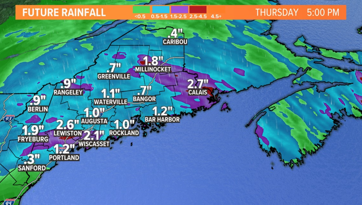
The heaviest rain bands will add up to more than one inch for your lawn or garden.
This will be a big help to the drought, and we will take every drop to put a small dent in the more than 8-inch rainfall deficit.
Comments are not available on this story. Read more about why we allow commenting on some stories and not on others.
We believe it's important to offer commenting on certain stories as a benefit to our readers. At its best, our comments sections can be a productive platform for readers to engage with our journalism, offer thoughts on coverage and issues, and drive conversation in a respectful, solutions-based way. It's a form of open discourse that can be useful to our community, public officials, journalists and others.
We do not enable comments on everything — exceptions include most crime stories, and coverage involving personal tragedy or sensitive issues that invite personal attacks instead of thoughtful discussion.
You can read more here about our commenting policy and terms of use. More information is also found on our FAQs.
Show less