Spring? Is that you?
The big warm-up and melt-off seem to be welcome in Maine, but days this warm in February always have a price.
The price for this one is wind and rain.
THE SETUP
Warm moisture-loaded air is being shoved into Maine and New Hampshire by some fairly strong winds on Thursday.
With a setup like this, some spots in York County could easily make it to 60 degrees, even without sunshine.
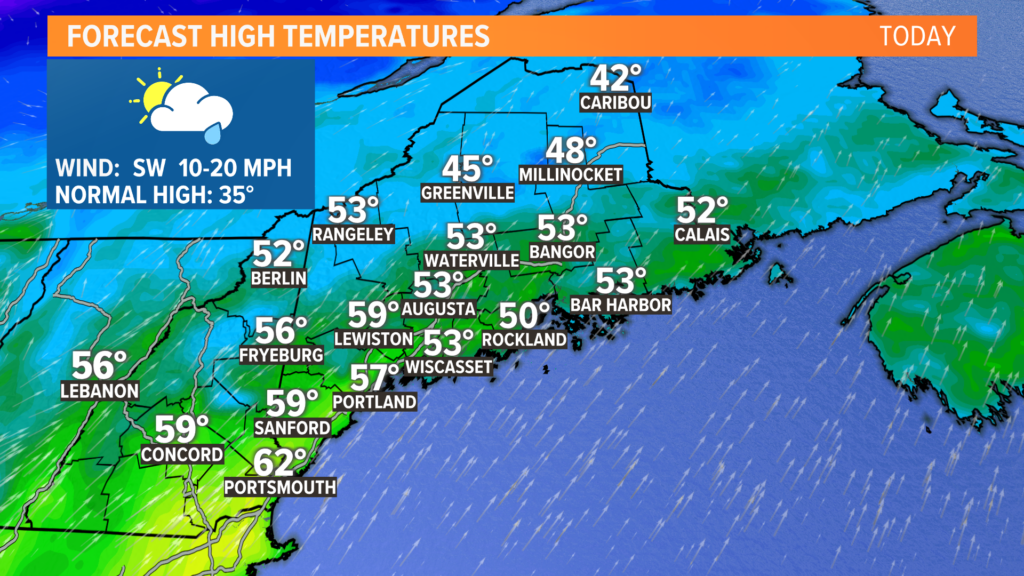
Temperatures will be high. The record in Portland is 58 degrees set in 1981. The record in Bangor is also 58 degrees. It was also set in 1981.
Both stand a chance at falling, but Portland is much more likely to actually get to (or above) 58 degrees on Thursday.
Dew points will also be quite high, which is arguably more significant.
The higher dew points and gusty winds will help melt the snowpack. Or, if you’re in southern Maine, the icepack.
Despite all this, the flooding threat still remains pretty low.

The bigger story comes with wind.
Gusts start to pick up out of the south and southwest later in the afternoon on Thursday and will last into Friday morning.
The strongest gusts will likely be across the midcoast and Down East, where gusts could exceed 50 or even 55 mph.
With a wind direction like this, some outages are certainly possible. I have more details on that in the “impacts” section below.
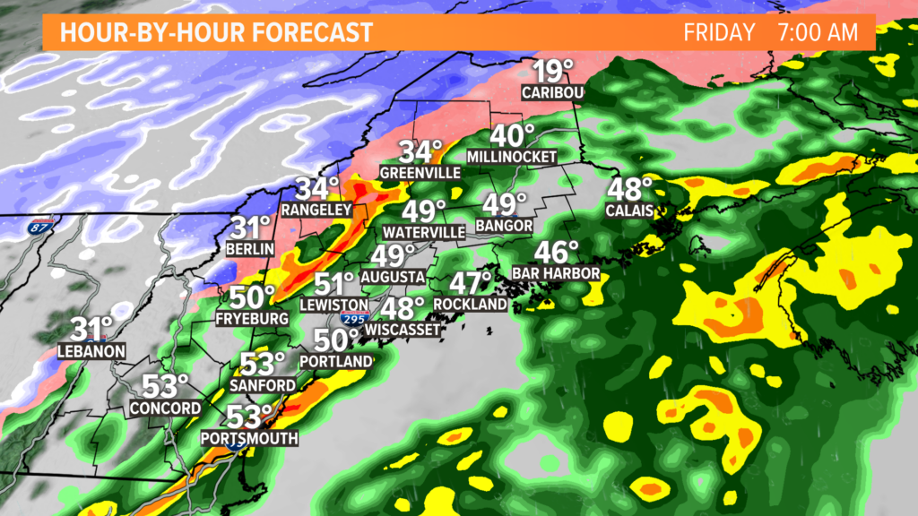
The cold front will pass through on Friday morning.
A line of storms will pop along the front. With milder air in place, some of these storms might even produce a little bit of thunder.
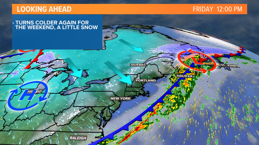
Colder air settles in very quickly behind the front, too.
Temperatures will drop from the 50s in the morning to the 20s by sunset. Watch for any standing water to freeze, but otherwise, I am not too worried about a big flash freeze. The breezy northwest wind will help dry most roads and sidewalks before the temperatures crash.
IMPACTS
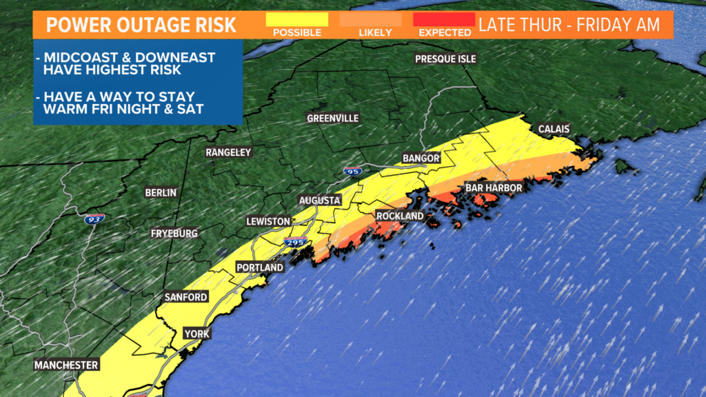
The biggest risk that I see is going to be power outages, especially for areas along the midcoast and Penobscot Bay.
Gusts coming out of the south tend to cause power issues. Coastal communities, especially on the islands, stand the biggest risk of losing power.
Some spotty outages will be possible in York, Cumberland, and Kennebec counties, too.
Greater Bangor should also prepare, though I expect lower outage numbers there.
While it may be warm when you lose your power, temperatures will crash quickly.
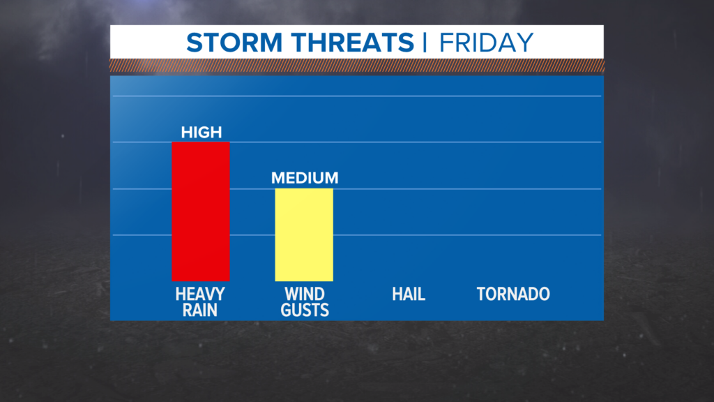
Overall, I think the flood risk is pretty low.
There could be some standing water near clogged drains, but ice jam and river flooding is pretty unlikely.
Since temperatures rebound a bit on Saturday, I do not expect a long-lasting flash freeze. Just keep an eye out for some slick spots early in the morning.
There will be some light snow showers Saturday, but accumulation is minimal.
The next thing to watch is a potential wintry mess on Tuesday. Cold and warm air will battle it out, and Maine is trapped in the middle.
More details on that, of course, as we get closer.
You can get more by following me on Twitter, @MikeSliferWX.
Comments are no longer available on this story