Somewhere in the distance, “All I Want for Christmas is You” by Mariah Carey is playing softly … .
Happy November. Whether you’re dreading the upcoming season or putting up your holiday decorations ASAP, it’s that time of year when things start to get pretty chilly and days get shorter.

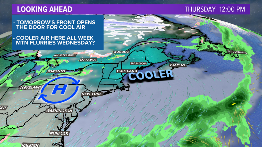
On the bright side, at least there is one last mild day to enjoy. A moisture-starved cold front passes through. No showers are expected, but that cooler air isn’t far behind.
High temperatures Monday afternoon will top out in the mid- to upper 50s. A brisk west wind develops, with gusts to 25 mph or so throughout the day. No need to worry about damage with this, but I’d get the Halloween decorations packed up quickly.

The cooler air arrives
A mix of sun and clouds on Tuesday will allow temperatures to make it into the low 50s. Nights will be cooler, too, from here on out. Temperatures in most locations will drop into the upper 20s or low 30s for Wednesday morning.

Wednesday is, arguably, the most interesting weather day.
A bit of energy way up high could be just enough for some showers to fire, mainly across the mountains.
Given the chilly weather and highs in the 40s, some flurries are possible on the high peaks. Elsewhere, expect intermittent clouds to pass by through the day.

A frosty start is on the way for Thursday morning. If there is a day where most towns start in the upper 20s, I think it will be Thursday.
High temperatures only make it into the 40s, despite the sunshine.
The Friday-through-Sunday window looks OK for now. There’s a storm, but it looks like it stays out to sea.
That, of course, keeps us locked in with cooler air.

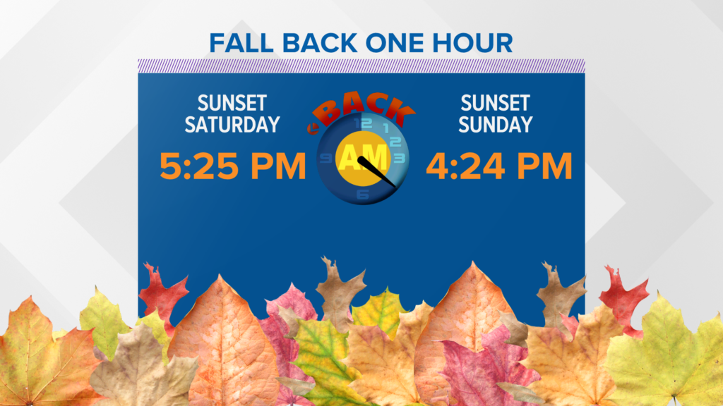
It will also feel appropriately cool outside when we do that dreaded November chore: turning the clocks back.
Not a bad idea to check the smoke detector batteries, too.
For more forecast info, you can follow me on Twitter, @MikeSliferWX.
Comments are no longer available on this story