
Here we go again! The remnants of yet another tropical system are sending moisture north, bringing the potential for soaking rain across Maine on Wednesday night and Thursday morning.
This one will track to our south, though, so northeast winds will keep cooler temperatures locked in place all day.
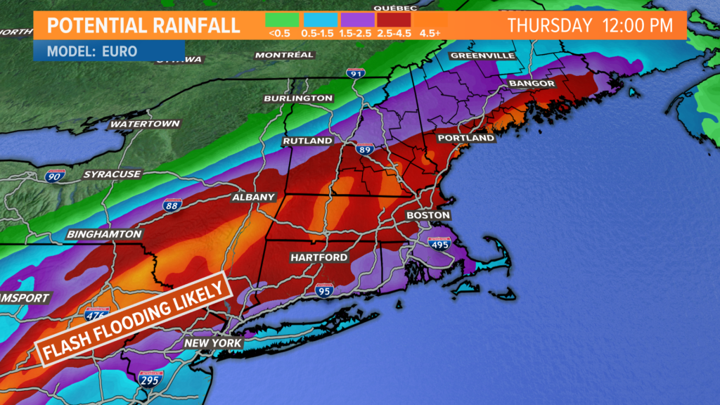
Given the amount of rain southern Maine has seen, soils have become saturated and some isolated flooding issues are certainly possible.
The biggest threat is likely in areas with poor drainage that tend to see standing water, but river and stream levels will also have to be monitored.
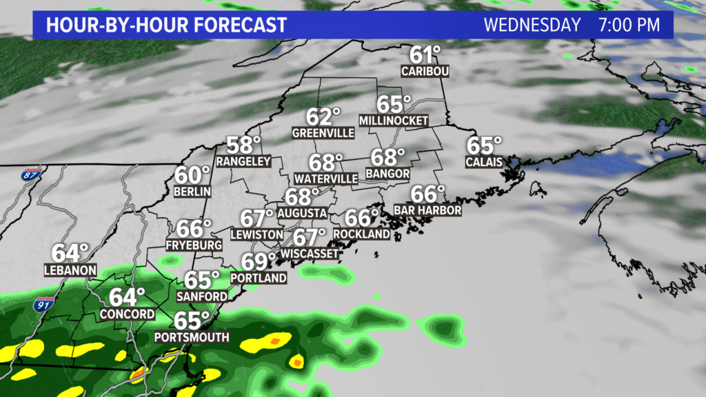
Rain begins around 7 o’clock on Wednesday evening across southern Maine. At first, expect rain to be fairly light.
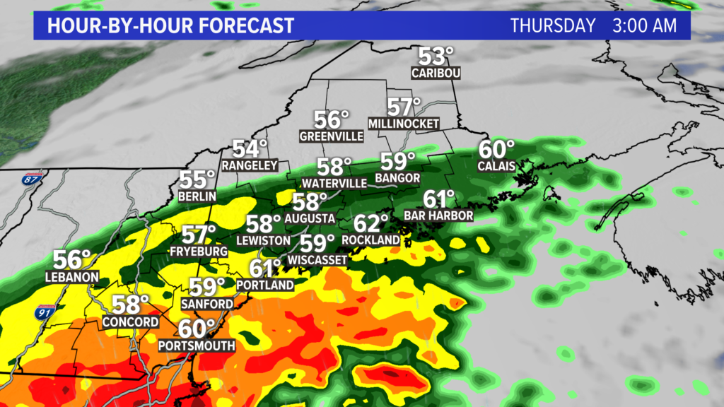
Rain will continue to ramp up overnight, especially across southern Maine and along the coastline.
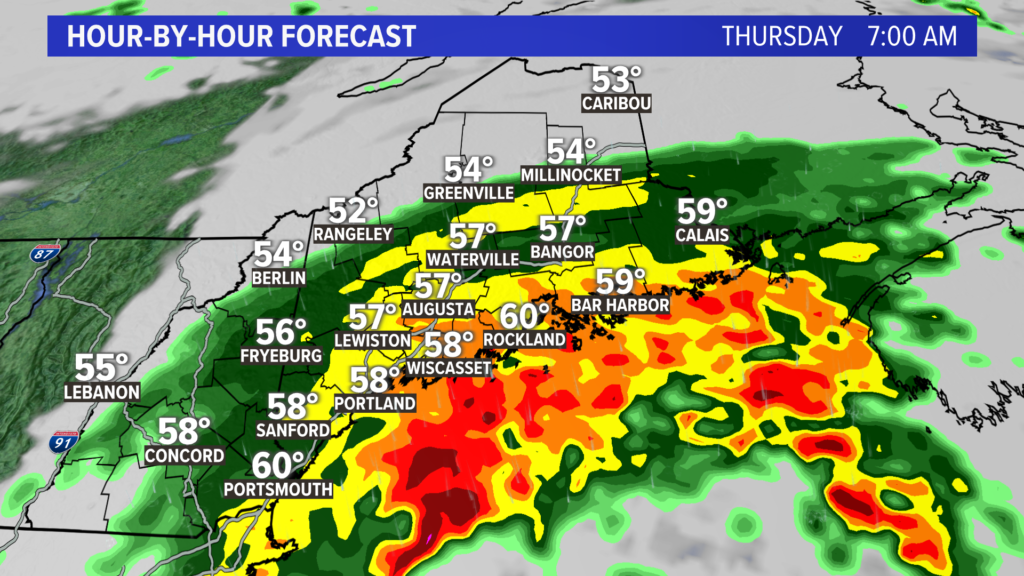
Expect the heaviest rain to fall between midnight and 8 a.m. Thursday.
Flash flooding may be possible in the height of the rainfall, since soils are saturated. This also could have impacts on the morning commute.
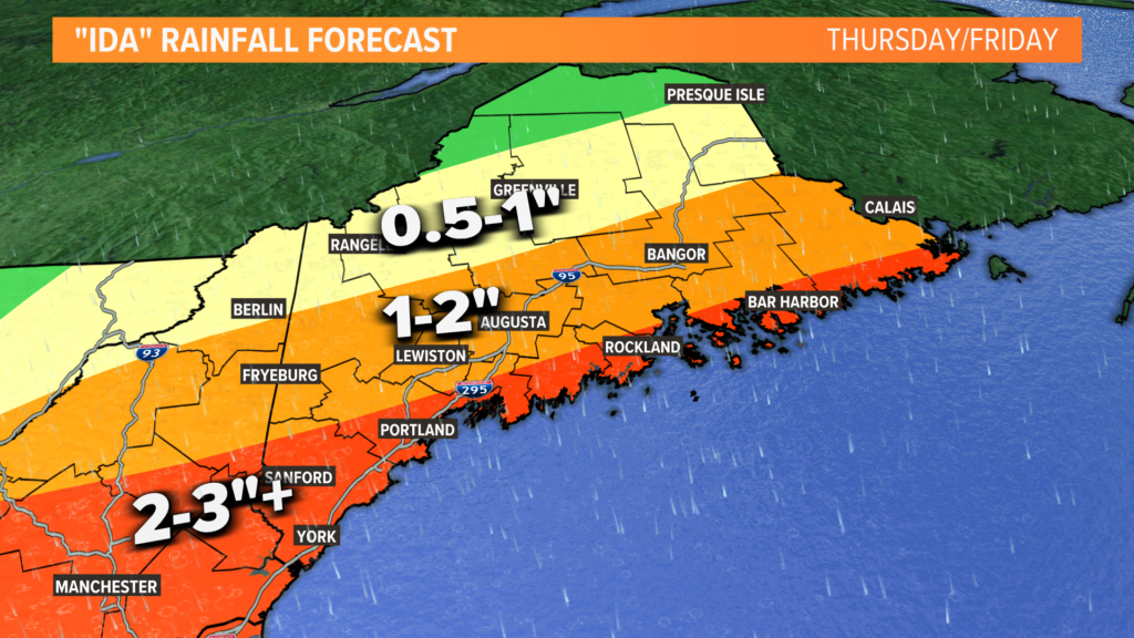
While there is some uncertainty about how far north the rain will make it, the coastline is still in for a solid 1-2″ of rain.
Given this forecast and the ample moisture available, some isolated reports of 3″ or even 4″ would not be a huge shock.
Highest risk for those upper-end totals would be across York county.
Flash flooding has already been an issue with this storm across portions of West Virginia, Maryland, and Pennsylvania.
While the threat to Maine is lower, there will likely be some significant flooding in parts of southern New England. Maine can certainly still some isolated issues, even if they will not be as bad as other areas.
Thankfully, the wind will not be a huge issue with this storm. I do not anticipate power outages or any wind-related issues with this storm.
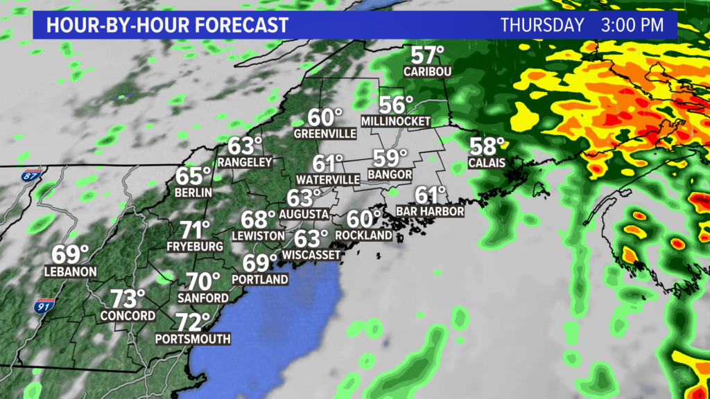
Dry air will wrap around the storm pretty quickly, so expect rapid clearing in the early afternoon on Thursday. The sun should help dry things out a bit in the afternoon, setting the stage for much nicer weather for the holiday weekend.
For the latest forecast info, follow me on Twitter, @MikeSliferWX.
Comments are not available on this story. Read more about why we allow commenting on some stories and not on others.
We believe it's important to offer commenting on certain stories as a benefit to our readers. At its best, our comments sections can be a productive platform for readers to engage with our journalism, offer thoughts on coverage and issues, and drive conversation in a respectful, solutions-based way. It's a form of open discourse that can be useful to our community, public officials, journalists and others.
We do not enable comments on everything — exceptions include most crime stories, and coverage involving personal tragedy or sensitive issues that invite personal attacks instead of thoughtful discussion.
You can read more here about our commenting policy and terms of use. More information is also found on our FAQs.
Show less