Two air masses, one Arctic and one tropical, are battling it out. The result is an active storm track, draped across the US and Maine.
We’ll get our shot at two wintry storm systems.
Most of this article will focus on the first one, since those potential impacts will be realized sooner. I’ll have more details on the second storm after we get through the first.
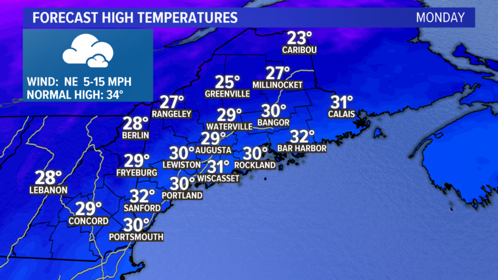
Monday will start pretty quiet, but the afternoon becomes a bit more complicated. Expect high temperatures to be fairly mild compared to recently, possibly even into the low 30s along the coastline. This is still below average for this time of year.
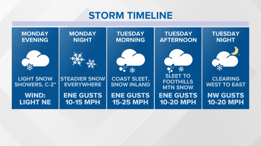
The first flakes from this storm fly on Monday afternoon. A coating to two inches is possible, but I think most will end up on the lower side of this range.
The storm will wrap up on Tuesday evening. Here’s a more in depth breakdown.
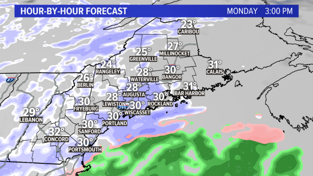
These snow showers Monday afternoon will be spotty. They’re the appetizer to the main event later in the evening.
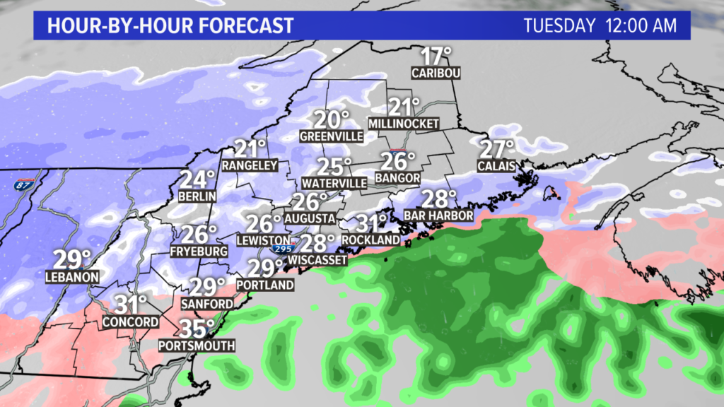
As the storm strengthens southwest of us, snow starts to edge in late Monday night.
Steady snow begins in the western mountains and throughout northern New Hampshire before midnight.
At the coastline, I still expect this storm to start as snow.
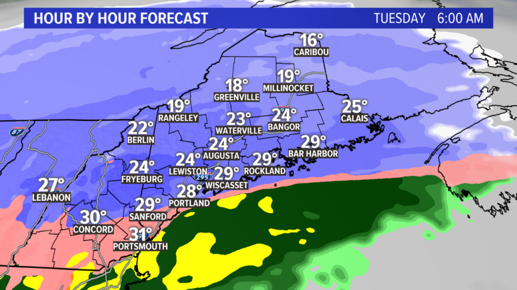
As sunrise approaches, the entire coastline will switch over to sleet, or at least snow mixed with sleet.
Just north of this mixing line, though, set up on a line from Fryeburg to Augusta, snow will be falling heavily.
Snowfall rates are forecast to reach or exceed an inch an hour. With the cold air locked in place well ahead of this storm, it’s looking pretty slick out there on Tuesday morning. Whiteout conditions are certainly possible under heavy snow bands, too.
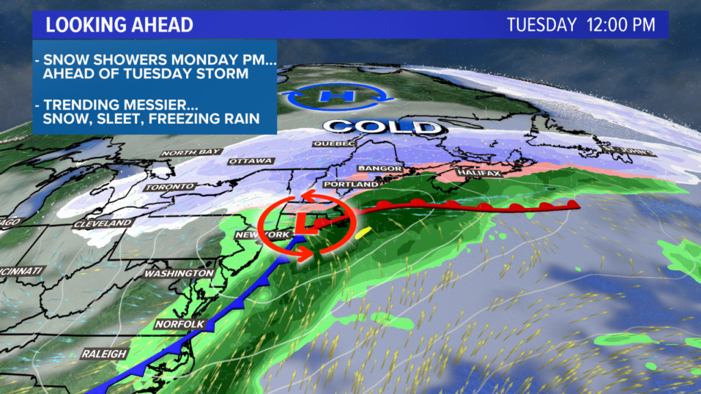
Through the afternoon, more and more warm air moves in over the cold air locked at the surface. The coastline will be mostly sleet. With a track south of Portland, I don’t see temperatures getting above 30 degrees anywhere.
Snow showers may settle south as the storm wraps on Tuesday evening. These will not really add much to the totals, but could allow for a few flakes before all is said and done.
The storm wraps entirely later Tuesday, with blustery and bright conditions Wednesday.
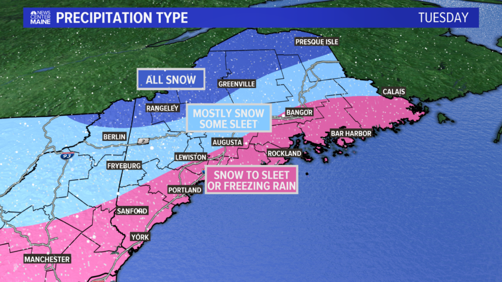
Another storm, another mess with sleet.
Good news with this map: I think the freezing rain threat is pretty small. The cold pool looks pretty deep, comparatively speaking, so that should keep things more on the sleet side.
It’ll still be pretty slick, though.
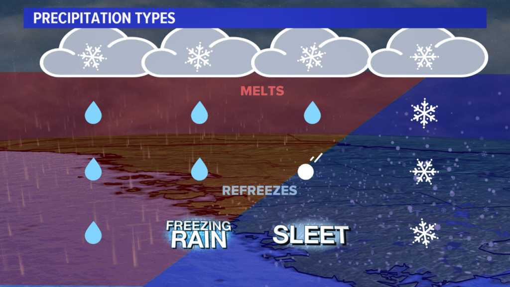
The schematic above is a good idea of the temperature profiles will work. I expect to be closer to the sleet and snow side of this.
There could be just a bit of freezing rain as the precip wraps up.
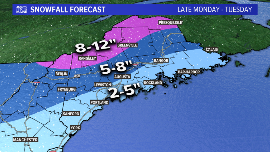
The highest totals will be in western and northern Maine. Central Maine might mix in a little bit of sleet, but there will still be about 5-8″ of snow.
The coastline is a bit less clear, thanks to the sleet. We’re thinking 2-5″ is a lock, but it could end up being slightly less, especially along the coast in York county.
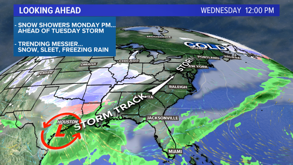
Locally, Wednesday will be bright and blustery. Temperatures stay between 25 and 30 for most.
What’s that brewing down south, though? Another storm!
There’s another storm threat for Thursday evening and Friday. It looks like it’ll bring another mixed bag, but this one might bring some regular old rain, too.
Even with warmer air, I expect a lot of this to start as snow on Thursday afternoon. The mixing seems more likely on Friday.
More details as we get closer.
Beyond that, the last week of February is trending milder. This could be the last bit of active weather for a week or two, depending on how it all shapes up.
For more forecast info, follow me on Twitter, @MikeSliferWX.
Comments are no longer available on this story