Another week, another wind storm.
While Monday started off dry, showers have started up in southern and western Maine. A couple showers could be moderately heavy, but the heaviest rain holds off a bit.
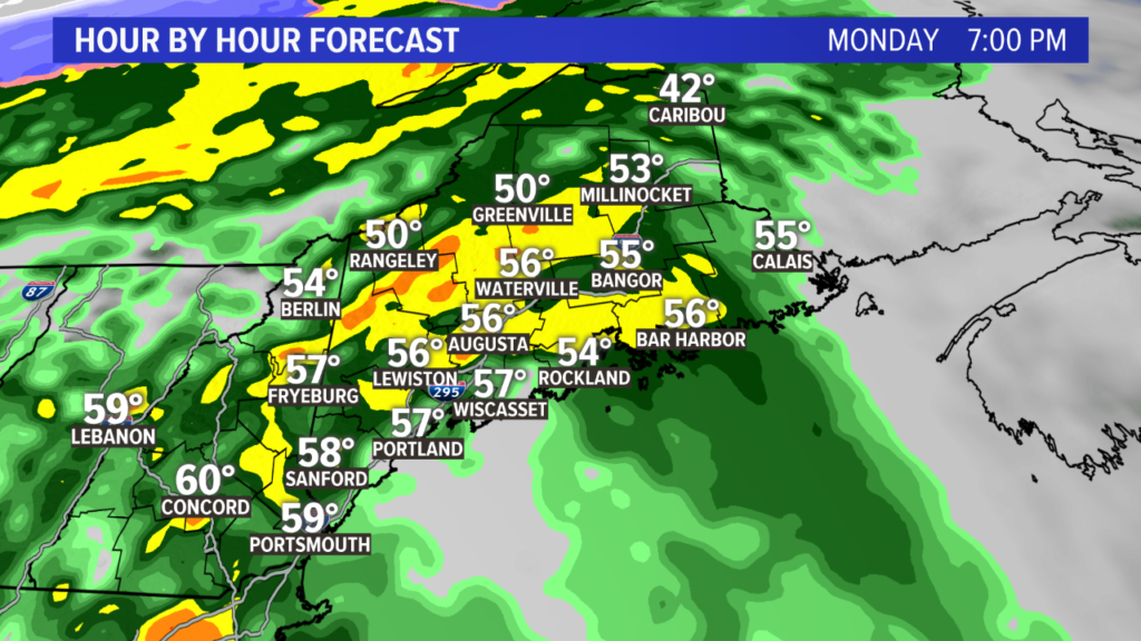
The conditions worsen through the afternoon and rapidly deteriorate for the evening and overnight. It’s important to note the temperatures here, too. They’ll surge into the 40s and 50s, indicating the warm front moving through. This assists in allowing some of the stronger wind gusts to get to the ground from the low level jet.
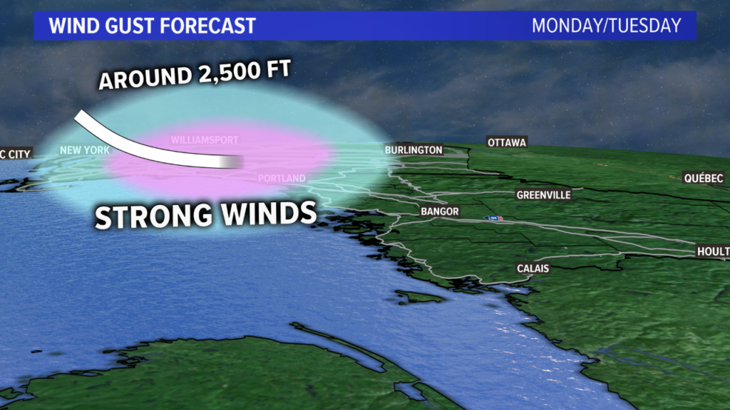
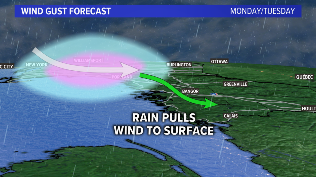
The low level jet is a stream of very strong wind just a few thousand feet above the ground. For this storm, it looks like wind above the ground could approach 80 miles per hour.
With a storm like this, the rain can assist in transporting some of that wind down. Wind gusts are never as strong as the low level jet. This is where the wind threat comes from Monday evening, since the low level jet will be pointed directly at coastal Maine.

Wind gusts will pick up from 7 p.m. and onward into the overnight hours. A few rumbles of thunder will be possible, too.
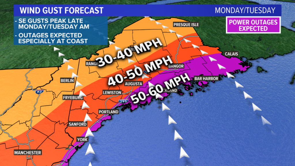
The highest gusts at the coastline will be in the 50-60 mile per hour range. The Penobscot Bay and Downeast have the best chances of actually getting gusts to or even slightly over 60 miles per hour.
With a southeast wind and gusts in the 50 mph range, scattered power outages seem most likely. If gusts end up closer to 60 mph, that is where widespread issues begin to pop up. For now, though, the forecast favors gusts to stay in the 50 mph range.
Gusts will max out for Portland in the late evening hours and the Midcoast in the early hours Tuesday morning.
Coastal inundation is unlikely since the tides are not all that impressive. Still, such strong wind gusts will result in some minor beach erosion. Widespread issues are unlikely.
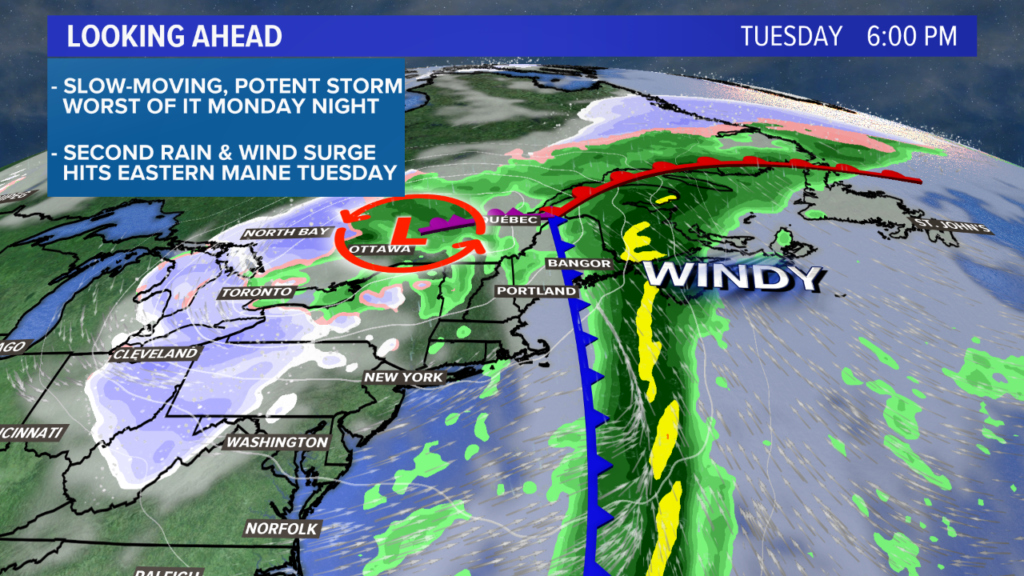
Showers are still possible Tuesday, but it looks like a drying trend takes hold through the day west of the Penobscot. Wind gusts Tuesday afternoon will be in the 30 mph range. Damage and more outages seem unlikely on Tuesday.
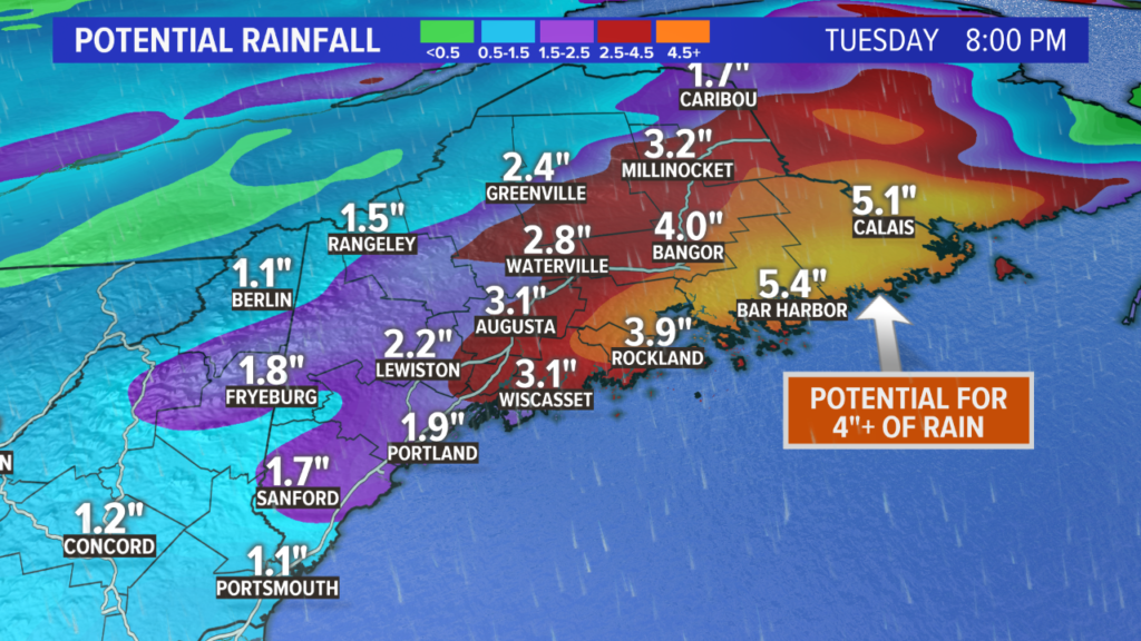
Rain totals for this event will be between 1.5″ and 3″ for most, with a few spots coming in slightly higher than this. Flooding seems unlikely given the dry year, but if enough rain falls in a short enough period of time, there could be some isolated issues in areas of poor drainage.

Some record high temperatures may be in jeopardy on Tuesday afternoon. The amplified pattern and tropical connection to the stalling storm will surge the warm air into our region. Some towns might even make it to 60 degrees…not too bad for the first day of December.
The remainder of the week will be seasonable. A stray shower is possible Thursday, but the big excitement for the week happens on Monday and Tuesday.
Follow me on Twitter if you want my forecast musings during this impactful weather event. If you don’t, you should follow me for my dog pics.
Comments are not available on this story. Read more about why we allow commenting on some stories and not on others.
We believe it's important to offer commenting on certain stories as a benefit to our readers. At its best, our comments sections can be a productive platform for readers to engage with our journalism, offer thoughts on coverage and issues, and drive conversation in a respectful, solutions-based way. It's a form of open discourse that can be useful to our community, public officials, journalists and others.
We do not enable comments on everything — exceptions include most crime stories, and coverage involving personal tragedy or sensitive issues that invite personal attacks instead of thoughtful discussion.
You can read more here about our commenting policy and terms of use. More information is also found on our FAQs.
Show less