Ah, Labor Day. The unofficial end of summer. The days are getting shorter, the nights are cooler, and normal high temperatures are closer to the 60s than 80.
That’s on a typical year, though, and 2020 has been anything but.
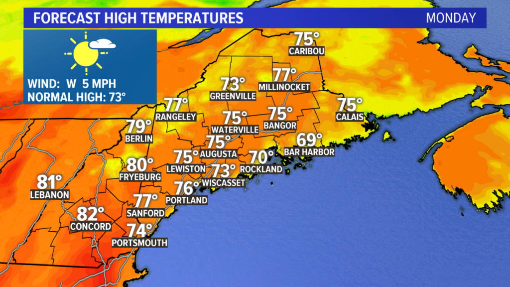
Monday’s high temperatures will be back into the 70s. With a strong breeze at the shoreline in the afternoon, keep an eye on water conditions. They may worsen later in the day.
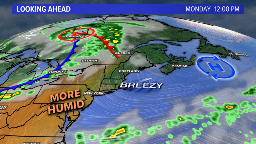
The south wind persists into Tuesday. Humidity climbs steadily through the week as warmer air pushes north.

High temperatures Tuesday are also going to be in the 80s widespread. Despite some morning fog, expect partly to mostly sunny skies through the afternoon.

The warm up continues on Wednesday as wind favors pushing in even more humidity. Highs again return to the 70s. Clouds increase as well, thanks to the winds pulling in more and more moisture.
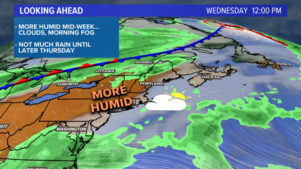
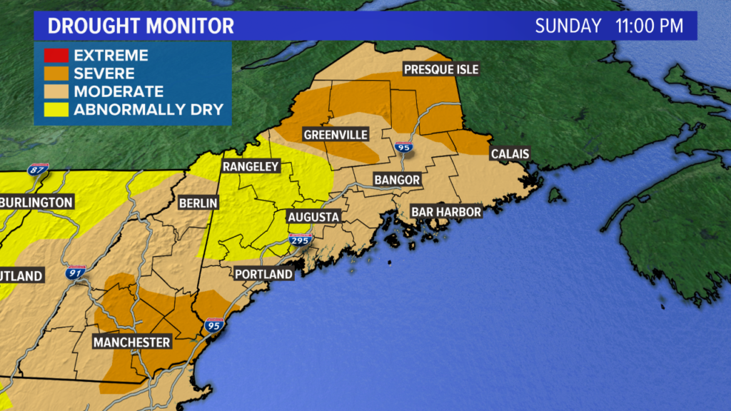
The rain chances return on Thursday. When this article was written, the entire states of Maine and New Hampshire were still running abnormally dry with moderate and severe droughts plaguing various areas.
The rain is welcome and much needed. Showers and storms are expected on Thursday afternoon as a cold front sweeps through.
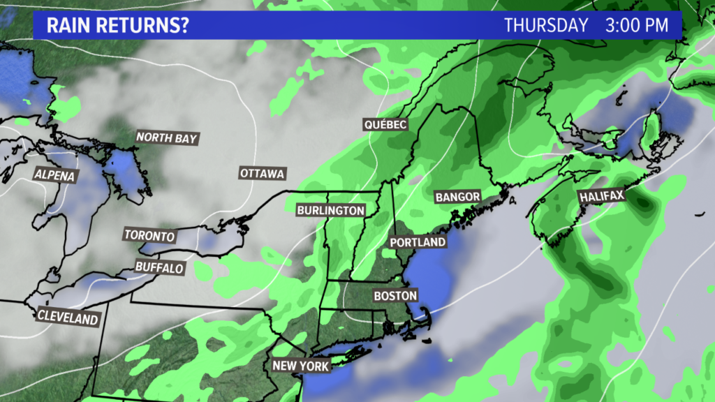
This will bring beneficial rain to Maine. Right now, the timing for showers will be focused through Thursday afternoon into early Friday morning.
The bright side – literally – is that front passing us means cooler, drier air settles in on Friday with sunshine for Maine. With a bit of luck, the sunshine could stick around into the weekend, too.
Make sure to check out my Twitter account for more forecast information.
Comments are no longer available on this story