Let’s start with a quick recap of July, since I missed that last week.
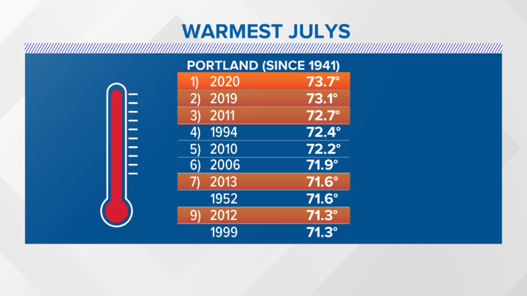
In Portland, July 2020 was the warmest July on record, beating out the previous record set all the way back in 2019. Five of the top ten warmest July months on record have occurred in the 2011-2020 decade.
More hot weather is on the way, starting Monday afternoon. High temperatures top out in the mid 80s for most. The day looks mostly dry, with a chance for just a couple of afternoon pop ups.
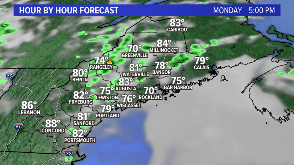
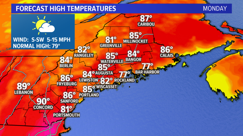
The heat and humidity keep building. The peak in high temperatures is likely Tuesday afternoon.
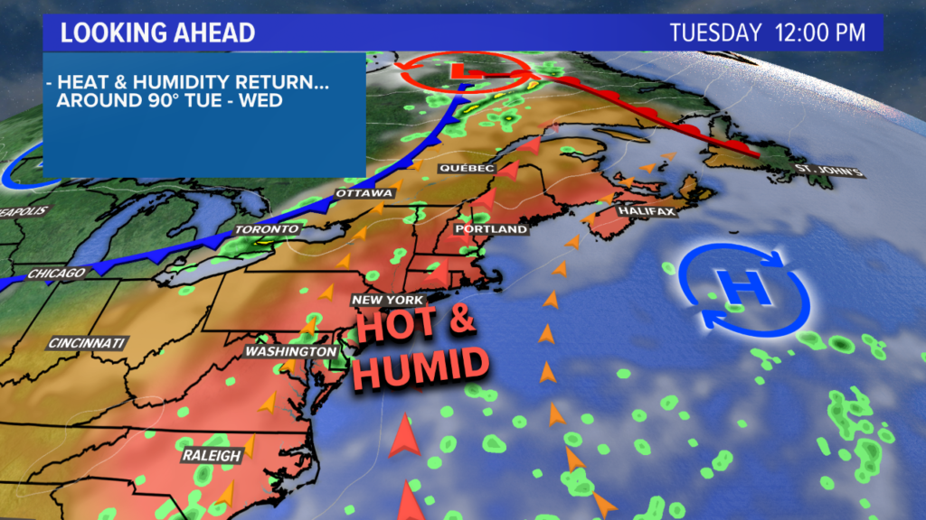
With a wind direction out of the west and southwest, ocean influence will be stopped pretty early on. There could be just a bit of patchy coastal fog Tuesday morning, but it will mix out quickly.
High temperatures will be widespread in the upper 80s and low 90s. With dew points well into the 60s and approaching 70, it will feel more like the mid to upper 90s outside.

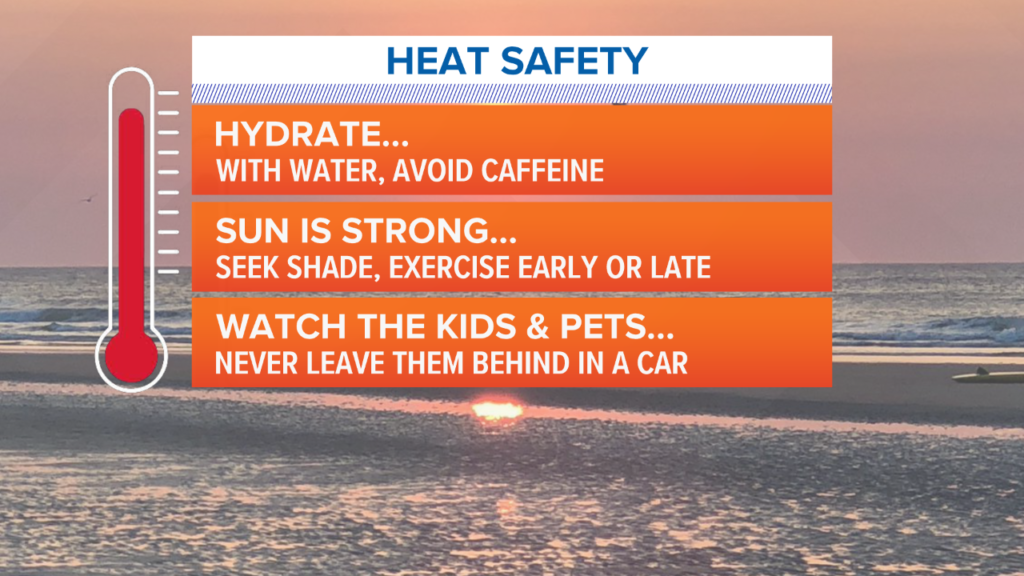
As always, it’s important to practice heat safety on days like this. The tips below will help you stay safe in the heat.
A couple of storms are possible Tuesday afternoon. While storms will be limited in coverage, any storms that do fire could be strong to severe.
There’s a better chance for some showers and storms on Wednesday as a cold front rolls in. Storms will be scattered in coverage. Again, a couple of storms could be on the stronger side.
High temperatures Wednesday will top out in the upper 80s and 90s before the front comes through.

Thursday looks a bit cooler, but it will take a little while for the humidity to clear out.
Friday will likely be the least humid, sunniest day of the week. High temperatures will return to the low to mid 80s.
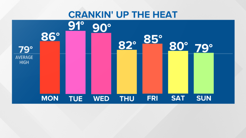
The jury is out on the weekend. With wind coming off of the ocean, it looks cooler. Some clouds may also come into play, and if we can get enough moisture, maybe even a couple of showers. Stick with me on Twitter and Facebook for updates as we get closer.
Comments are no longer available on this story