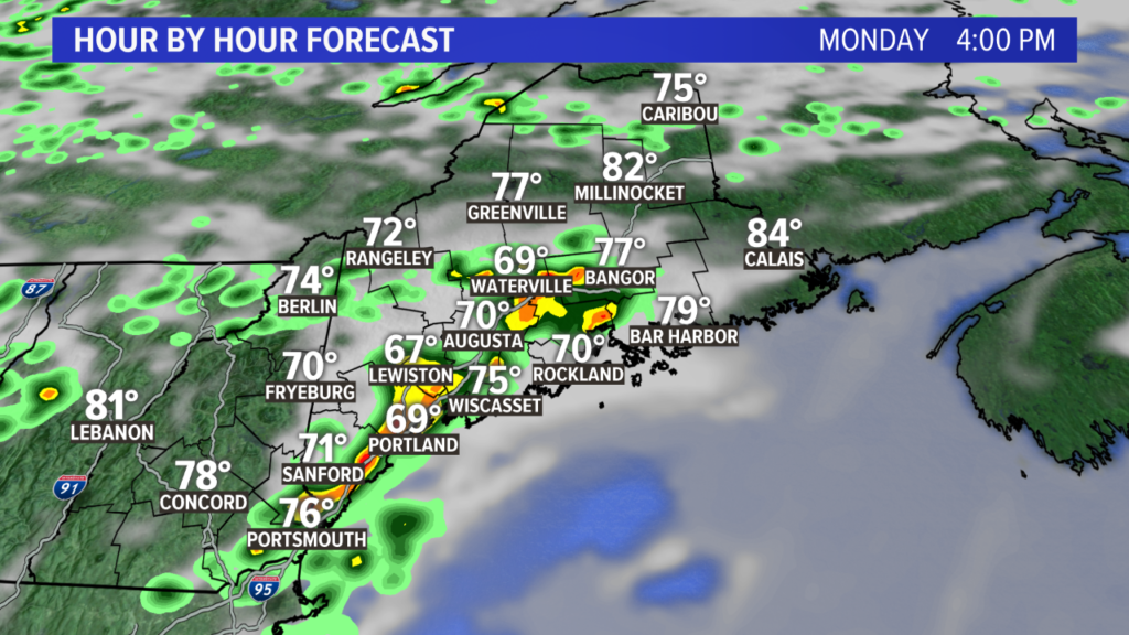
Some showers and thunderstorms are expected to fire up around 2 p.m. this afternoon, and as they build in, a couple could be strong.
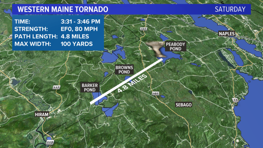
What a weather weekend in Maine. The tornado that occurred near Hiram on Saturday was the first confirmed tornado in Maine this year. Maine averages two tornadoes per year.
It was an EF0 and was on the ground for 4.8 miles.
Thankfully, I don’t think we will be talking about tornadoes this week.
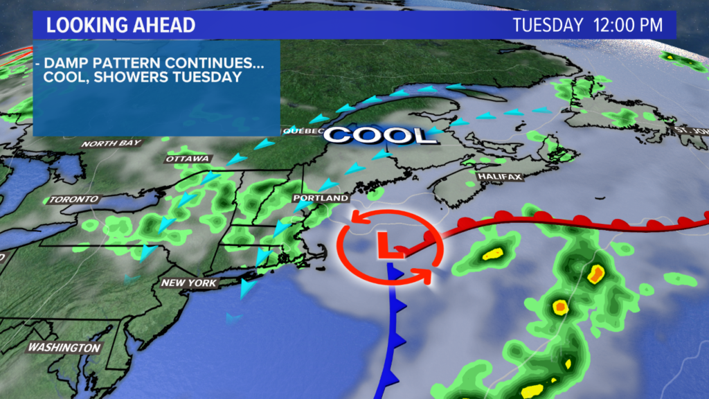
Tuesday will be a very different day compared to this short blast of heat we’ve seen. High temperatures struggle to break 70 for some, with the highest highs likely under 73 degrees. A bit chilly for this time of year, all things considered!
Showers will be around and it looks pretty cloudy. Not exactly a beach day; but we could all use the rain, so we’ll take it.
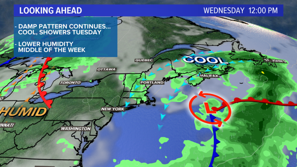
The unsettled weather continues into Wednesday. Watch out for some fog on Wednesday morning. It could be dense in spots, but all things considered, I think it will be a better day than Tuesday.
Highs should be back into the mid 70s and there could be a few breaks in the clouds, especially later in the day. Still, there will be some showers around and the pattern remains active.
Thursday will start off with some fog before drying back out. Highs on Thursday jump into the mid to upper 70s, with a bit of sunshine through the early afternoon.
After that, showers and storms will try to fire back up, especially inland. By the evening, showers steadily increase leading to rain overnight.

Friday looks pretty rainy, too. It could end up being similar to Tuesday, but right now it pushes through just a little faster, so that should give us a break later in the day. The next day with highs in the 80s will be Saturday.
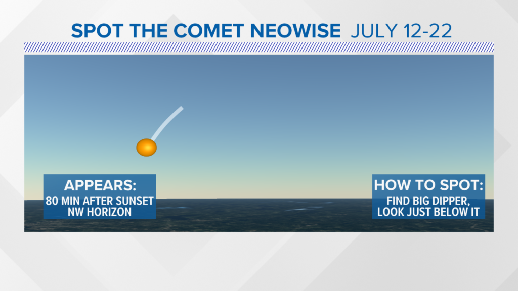
If the clouds break at all, keep an eye to the northwest sky about 80 minutes after sunset for the next 10 days. This is where the comet Neowise will be. The graphic below explains how to spot it.
For more forecast updates, follow me on Twitter and Facebook.
Comments are not available on this story. Read more about why we allow commenting on some stories and not on others.
We believe it's important to offer commenting on certain stories as a benefit to our readers. At its best, our comments sections can be a productive platform for readers to engage with our journalism, offer thoughts on coverage and issues, and drive conversation in a respectful, solutions-based way. It's a form of open discourse that can be useful to our community, public officials, journalists and others.
We do not enable comments on everything — exceptions include most crime stories, and coverage involving personal tragedy or sensitive issues that invite personal attacks instead of thoughtful discussion.
You can read more here about our commenting policy and terms of use. More information is also found on our FAQs.
Show less