There are a couple of big pattern signals we look for each winter that signal sustained cold, and imply snow. Through most of January, February, and now March, those signals were nowhere to be found.
We celebrated the spring equinox on March 19. For the Mainers who don’t partake in winter activities, it’s time to get out and enjoy some warm days! But, did we rush into the new season a bit too quickly?
Our weather pattern thinks so. The general set up for Monday and Tuesday is fairly wintry in nature and brings more springtime snow showers to Maine.
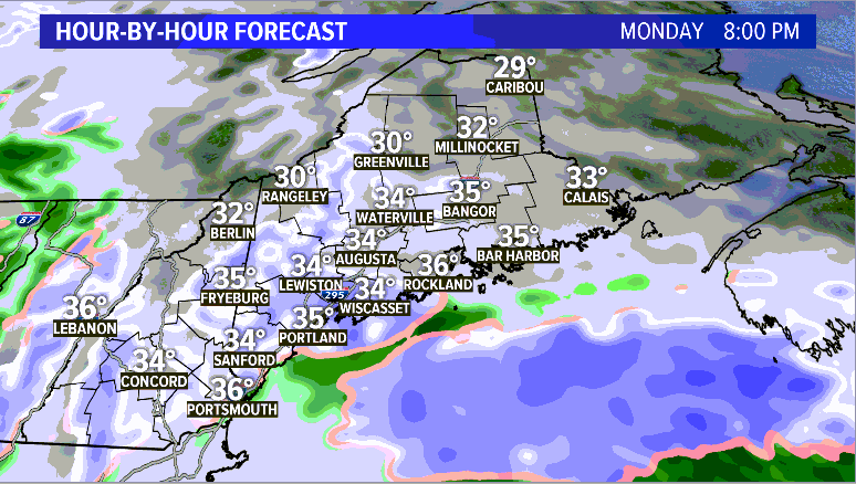
Sunday brought some wintry precip to the state. As the storm sits overhead Monday and drifts east, it will pull some colder air in with it.

Since there is not quite as much moisture, the snow will not be as steady and falls as lighter snow showers. Expect these to taper off gradually through the evening.

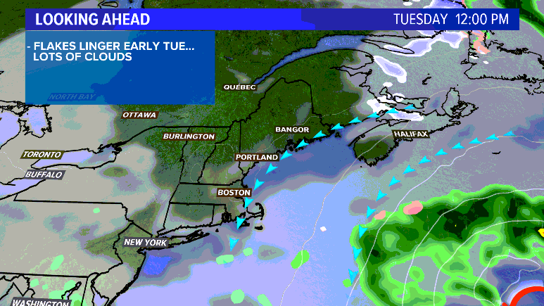
The storm slides east on Tuesday, leaving a cooler and drier day in its wake. The clouds likely stick around all day, even though showers will be done. Temperatures stay in the low 40s.

Wednesday looks quiet and cloudy, too. Highs do climb a bit, with most topping out in the mid 40s.
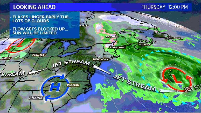
Thursday will be the next chance for showers. Expect mostly rain showers. It’ll be cooler inland, in the 40s. Coastal areas have a chance at 50 degrees.

Highs do make it back into the 50s for Friday and sunshine returns Saturday. By the time the weekend rolls around, I think we will ALL be ready for some sun.

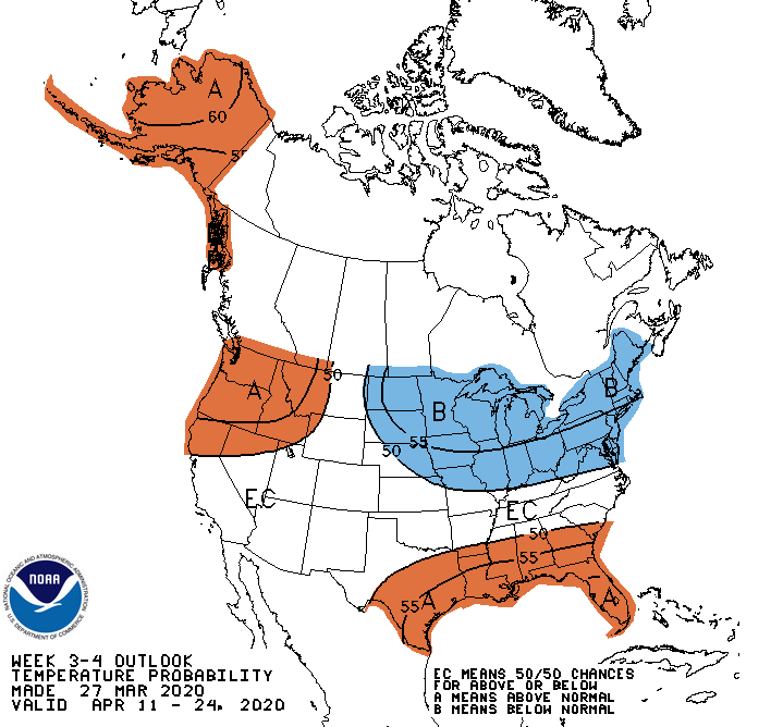
See this, though? Looks like the pattern is going to favor cooler days for the next few weeks. This doesn’t mean that every day will be cold, but we will likely see more below average days than above. It seems that maybe, just maybe, winter isn’t ready to let go. We’ll see if this translates to more April snows.
Be sure to follow me on Twitter and Facebook for more forecast info and maybe some beauty pictures of Maine. It’s almost that time of year where I bring my camera around with me. Almost.
Comments are no longer available on this story