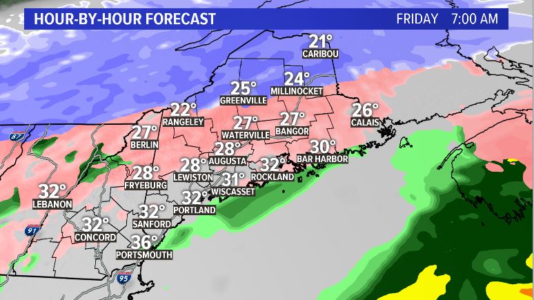
The second part of this winter system is here for a while. Friday morning’s commute is a preview of what to expect for the rest of the day as freezing rain and sleet keep coastal and central Maine slippery. The majority of the snow is confined to the western mountains and across Aroostook County.

More wintry precip is expected through the day. What exactly does this mean? Well, road crews are going to have their work cut out for them. This is one of those storms where it’s a lot of playing catch-up as the freezing rain and sleet continue to fall.
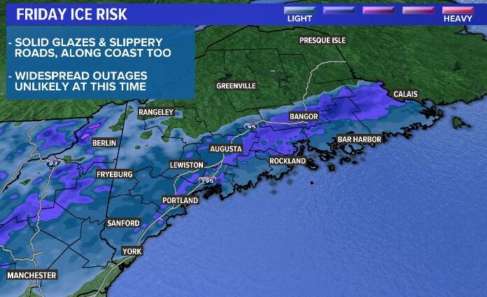
The best chance for ice accretion from freezing rain is highlighted below, mainly across portions of central and southern Maine. While widespread power outages look unlikely, some isolated issues may present themselves. The backside of this storm will be a bit breezy Friday night, and that could allow for just a few power-related issues to pop up.

Ice totals will be highest just a bit inland and removed from the coast.
Some spots right along the coast, especially Down East, could transition to cold rain later in the day. Still, travel will continue to be difficult.
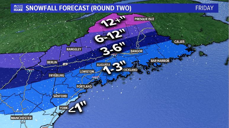
As the storm pushes away, it draws in cold air and transitions everyone to snow. This will add on to the snowfall amounts that were picked up on Thursday. The biggest increase in totals will be through the County, where another foot or more of snow may fall.

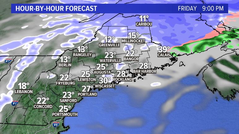
The storm wraps up Friday evening and clearer, colder conditions hold for the weekend. Don’t let the sunshine fool you, though…it’s going to be cold.

Follow me on Twitter and Facebook for more storm coverage and some updates on next week’s active forecast.
Comments are no longer available on this story