We all know the classic holiday songs that tout a white Christmas, but what about a white new year?
It looks like we could enter 2020 with a fresh coating of snow. Actually, it will likely be more than a coating for most. Expect some travel issues starting Monday morning.
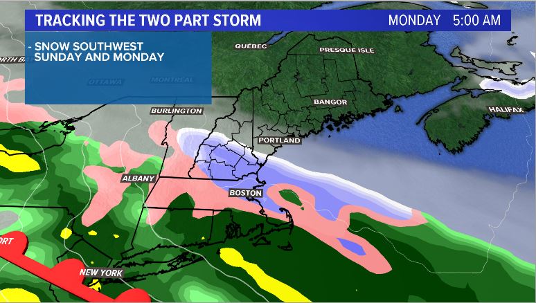
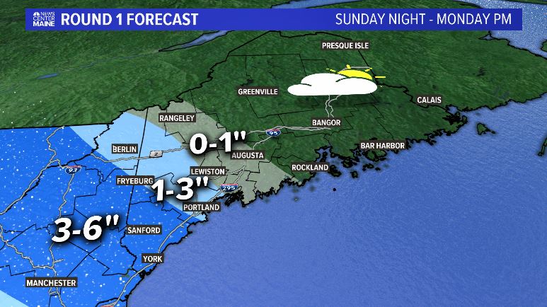
The storm comes in two parts, with the first batch of snow in southwestern Maine starting late Sunday night and into Monday morning. This will likely bring reduced visibility and slick roads to York and Cumberland counties at the beginning of the week.

Snow gradually spreads through western Maine while eastern and northern Maine stay dry. There could even be some breaks of sun in eastern parts of the state.
The totals from this first band could exceed a few inches, especially in some of the hill towns along the New Hampshire border. Below is a forecast map from late Sunday until around 5 p.m. Monday evening.

This is just round one, though.
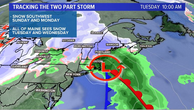
Another blast is on the way for Tuesday as a coastal storm develops. This low pressure will allow snow to cover the whole state. Expect some commute impacts through the day on Tuesday. This applies for anyone who has to travel to their New Year’s Eve destinations.

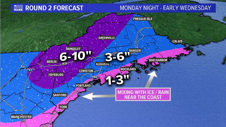
Most Mainers see snow, but some mixing is likely along the coastline. Either way, travel does not look great.
The more impressive snow totals for this event come from this secondary low front that forms. It allows snow to fall across interior Maine at a decent rate. The map below highlights snow totals from 5 p.m. Monday through Wednesday morning.

All told, travel with caution and care for the last days of 2019. Messy roads are expected everywhere. Traffic will already be a bit higher as people head back from their holiday destinations.
For more storm coverage, you can follow me on Twitter and Facebook.
Comments are no longer available on this story