Snow greeted us at the beginning of December, just in time to make it look a bit more like the holiday season.
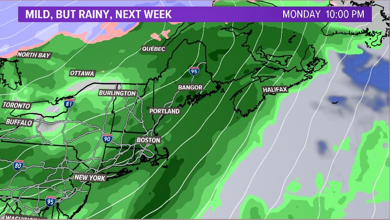
That snow is about to bid us farewell, though. A warm Monday and Tuesday along with rain will wash most of the snow across southern Maine away. While some snow in northern Maine survives, rain definitely wins this round in southern Maine.

The onset of precipitation Monday might bring some wintry mix to inland Maine. Some freezing rain could mix in, but with such warm air building in so quickly, we scour out the cold by the middle of the day. Only the deepest valleys in western and central Maine could see cold stick around through the evening, at which point the warm air still wins.
Temperatures on Monday get close to 50 degrees. Highs on Tuesday make it into the mid 50s. This is going to feel quite warm compared to our recent cold pattern!
With recent snowfall and heavy rain, it’s important to keep storm drains clear. Ponding of water could be an issue if storm drains get backed up.
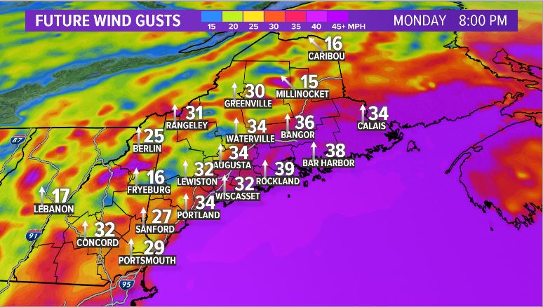
Wind becomes stronger on Monday afternoon, leading to some gusts at or over 40 mph overnight into Tuesday. Widespread power outages look unlikely. Still, some isolated issues could pop up.

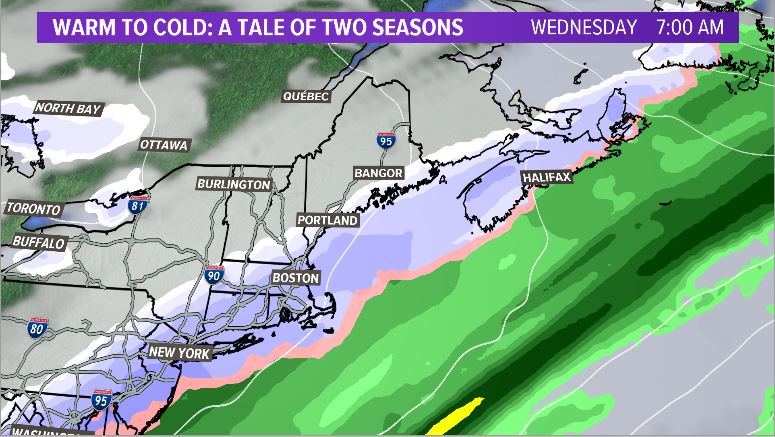
Tuesday afternoon might allow for a few breaks of sun before our cold front overnight. That brings us back to December, and temperatures crash.
It could get cold enough to bring some snow through right after it passes. Chances are slim for all to see snow, but accumulation could approach an inch along the coastline Wednesday morning.

Thursday looks bright, breezy, and very cold. High temperatures only make it into the 20s.
Clouds will be back on the increase late in the week with another bout of rain on the way for Saturday.
Make sure to give me a follow on Twitter and Facebook for your forecast needs.
Comments are no longer available on this story