An Arctic front is on the way, bringing another chance of snow and a wintry mix and more cold days for November.
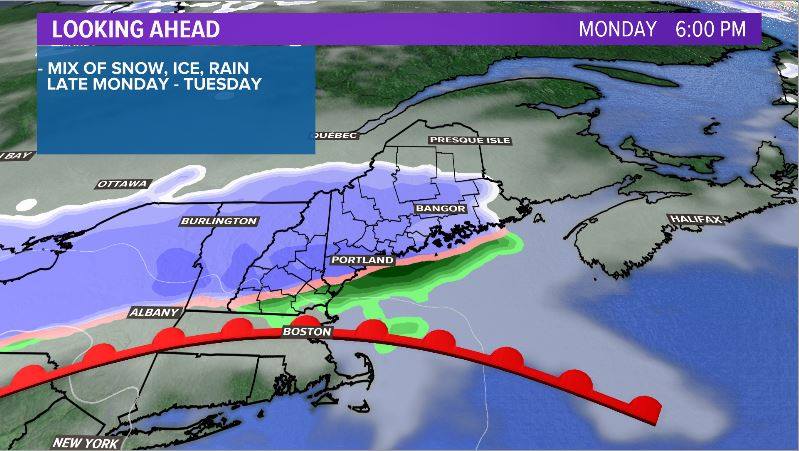
A warm front lifts north during the day on Monday. There might be some spotty pop up showers out ahead of it, but that is just a precursor to the snow later in the day.
Western mountains in Maine will see snow showers start up in the early afternoon. These gradually spread to the east, bringing snow showers to the western half of Maine by 5 p.m. Monday. Some mixing will be possible south of the foothills. The best chance for rain to mix in will be along the coastline.

Snow showers continue their eastward spread overnight. Throughout southern Maine, some mixing will be possible even overnight. Some spots end up with a few hours of dry time, too.
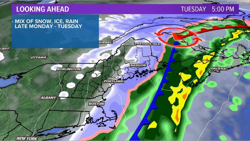
Slick conditions will be an issue for the morning commute on Tuesday. A wintry mix spreads back over Maine, including the I-95 and Route 2 corridors. Snow will continue in the mountains. The shoreline could see a bit more rain mixed in with this next burst of precipitation.

The low will move east, bringing the moisture with it. Areas in eastern Maine will see more snow during the evening commute than during the morning on Tuesday. This will likely cause slick spots during the commute that were relatively dry during the morning.

Snow wraps up quickly from west to east Tuesday evening. By 10 p.m., most spots will be done with snow. A few more snow showers will linger in the mountains and northern Aroostook County.
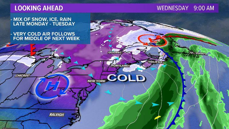
Cold air filters in quickly. Low temperatures fall into the teens and 20s. Anything that is still wet will freeze over, bringing back the threat of some black ice for the morning commute on Wednesday.

Temperatures will be running roughly 20 degrees below average on Wednesday. Most towns will struggle to make it above 30, even on the coastline. Blustery conditions will make it feel even colder outside.
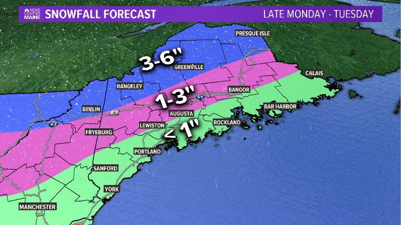
Snowfall totals may not look all that impressive, but slick roadways will likely be an issue. Impacts to the commutes on Tuesday and Wednesday are anticipated to be widespread.

Relief comes on Friday as temperatures get a bit closer to normal.
Follow me on Twitter and Facebook for more updates and coverage.
Comments are not available on this story. Read more about why we allow commenting on some stories and not on others.
We believe it's important to offer commenting on certain stories as a benefit to our readers. At its best, our comments sections can be a productive platform for readers to engage with our journalism, offer thoughts on coverage and issues, and drive conversation in a respectful, solutions-based way. It's a form of open discourse that can be useful to our community, public officials, journalists and others.
We do not enable comments on everything — exceptions include most crime stories, and coverage involving personal tragedy or sensitive issues that invite personal attacks instead of thoughtful discussion.
You can read more here about our commenting policy and terms of use. More information is also found on our FAQs.
Show less