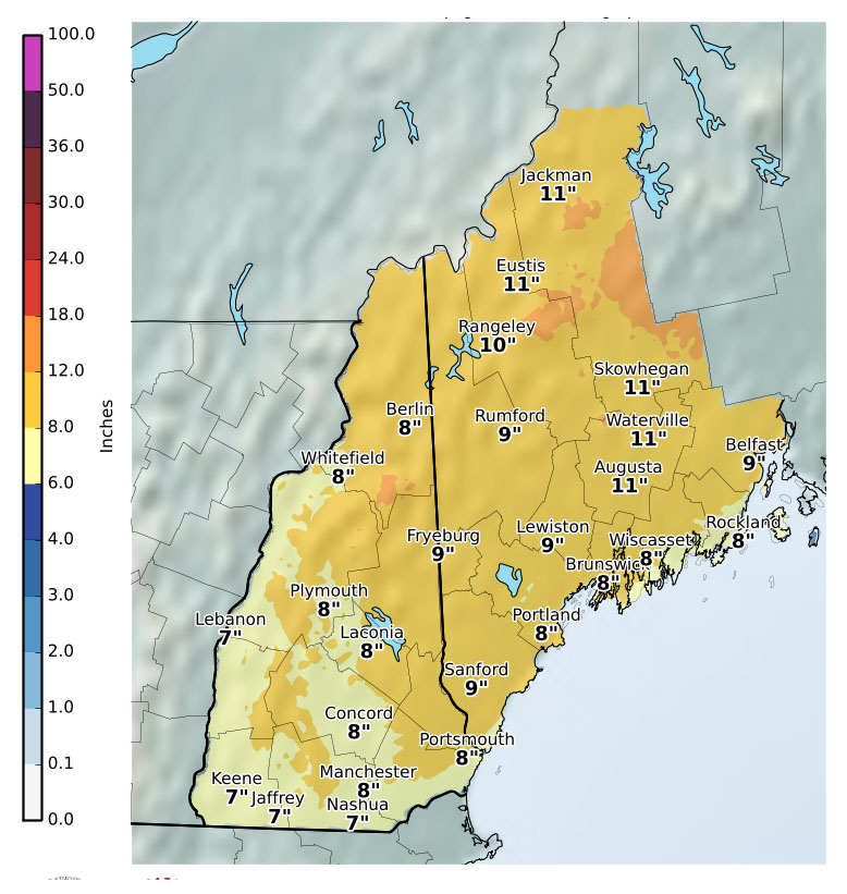
A Christmas Day snowstorm is answering a lot of holiday wishes in Maine.
The storm moved into the southern part of the state early Monday morning and spread north, reaching Down East Maine and northern stretches by daybreak.
The storm is really intensifying right now. We are starting to see snowfall rates of around 2-3" per hour in the heavier bands. Winds are beginning to gust now and many locations are reporting visibility less than 1/4 mile. pic.twitter.com/4JdqIRQhxZ
— NWS Gray (@NWSGray) December 25, 2017
Michael Ekster, a meteorologist with the National Weather Service office in Gray, said there’s a slight risk of power outages because some trees didn’t shed the ice from the storm that hit Friday and Saturday and are at risk of snapping if snow piles on top of those icy buildups.
If holiday gift-giving plans include a car with one of those big bows on top, make sure it’s parked in a driveway. Some towns announced Sunday that they would ban on-street parking starting before dawn Christmas Day. They include Falmouth, where on-street parking is banned from 1 a.m. to 10 p.m. Monday; Brunswick, where it’s banned from 2 a.m. Monday until 7 a.m. Tuesday; and Scarborough, where it’s banned from 4 a.m. until 11:30 p.m. Monday.
Complete list of storm closings and delays
After the storm moves out late Monday, any winter gear received as presents will come in handy, with temperatures dropping sharply by midweek.

Ekster said highs in southern Maine will be in the single digits Wednesday and Thursday, with daytime wind chills at zero or below. Highs in northern Maine will be zero to minus 5 at midweek, Duda said.
Ekster said there’s a chance of another snowstorm next weekend in time for New Year’s Day.


Comments are no longer available on this story