When the news broke last week that Yarmouth-based mapping firm DeLorme had laid off 10 workers as part of a shift toward technology-based products, some of its loyal paper-atlas customers freaked out a bit.
The company started getting calls from people worried that it was shifting to a digital-only business model, executives said.
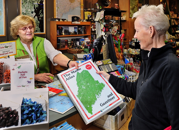
That’s far from the case, said Kim Stiver, vice president of marketing at DeLorme, which started out publishing the Maine Atlas & Gazetteer in 1976 and has since evolved into a high-tech company.
“Just because it’s paper doesn’t mean it’s going away,” Stiver said.
The company has a variety of map products, and a different set of competitors for each type of product it sells.
The competition for paper atlases includes major publishers such as Rand McNally, Merriam-Webster and Oxford University Press.
Producers of digital maps for the home computer include heavy hitters such as Microsoft and Google.
Competing mobile GPS communication and rescue device makers include Magellan, Garmin and Spot LLC.
When it comes to mobile devices, the number of firms developing map-based applications is too many to count, one map expert said.
Patrick Kennelly, co-director of the Mobile GIS App Development Program at LIU Post university on Long Island in New York, said there are still ample opportunities to combine mapmaking and software development.
Mobile digital technology is driving a renaissance in cartography, said Kennelly, a geography professor.
“It has really made maps so accessible,” he said. “It has made a lot more people mapmakers.”
There are apps that map out restaurant locations, crime rates, schools, homes for sale, and hundreds of other geographic features. Kennelly said it’s the ease with which such maps can be produced and updated that has led to their proliferation.
“Maps really aren’t the kind of static documents they used to be,” he said.
DeLorme never has stopped making paper atlases and maps, which remain a steady part of the business, Stiver said.
But it also has been a leader in the development of several technology products, including CD-ROMs, automatic routing, mobile apps, hand-held GPS systems and satellite messaging devices for outdoor adventurers. The company holds 17 patents for a variety of technologies.
Like most industries, mapmaking has adjusted to changes in what technology can do and what consumers want, business experts said.
In his 2013 book “On the Map,” author Simon Garfield argues that the digital revolution has transformed the way people use maps more than any other technological advancement since prehistoric humans first scratched out rough depictions of their surroundings on the walls of caves.
“The Internet has effected an extraordinary and significant change,” Garfield writes. “Now we each stand, individually, at the center of our own map worlds. On our computers, phones and cars, we plot a route not from A to B but from ourselves … to anywhere of our choosing.”
The impact of information technology on DeLorme has been equally dramatic, its executives said.
DeLorme’s foray into the digital world occurred in 1991, when it released Street Atlas USA, one of the first CD-ROM products of any kind for consumers.
According to DeLorme, a privately owned company that does not disclose financial information, Street Atlas USA was a huge success that helped establish the entire consumer CD-ROM industry.
“The decision to put a map on CD-ROM was the first step toward being a tech company,” said Jim Skillings, DeLorme’s vice president of commercial products.
But the two technologies that have affected DeLorme most as a business are satellite communications and the Internet.
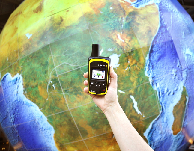
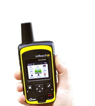
DeLorme’s most recently released technology product, launched earlier this year, is inReach SE, a hand-held device that boasts the ability to send and receive text messages anywhere on Earth, from the Amazon jungle to the South Pole.
It also can pinpoint the user’s location for others to see via a Web page or mobile app, and it has an “SOS” button that allows the user to call for a search-and-rescue team in an emergency.
The device is now in its third generation and has evolved with each iteration, Skillings said.
For example, the latest version of the inReach has its own digital screen for sending and receiving text messages. Previous versions required the user to pair the device with a smartphone or tablet in order to send and receive texts.
The device relies on the Iridium satellite constellation, a network of 66 active communications satellites in low-Earth orbit, to send and receive messages from any location on the planet. It costs $300 and requires a service plan that ranges in cost from $10 to $50 a month.
While the inReach sounds like something James Bond might use, Skillings said its primary consumer base consists of hikers, climbers, campers, hunters and other outdoor enthusiasts.
It might seem strange for a mapmaker to be manufacturing two-way satellite communicators at its headquarters in Maine, but it’s not at all unusual for advancements in technology to send traditional industries spinning off in different directions, said Matthew Dean, director of the Maine Center for Business and Economic Research at the University of Southern Maine.
There is even a term for it, Dean said: “disruptive innovation.”
Disruptive innovation is an advancement so powerful that it forces an entire industry to change, he said. It has happened in all areas of publishing, including maps, books, magazines and newspapers.
It’s not a new phenomenon, either, Dean said. Disruptive innovations have been changing the way companies do business for centuries.
“Think of the printing press,” he said.
Technology products now make up about 50 percent of DeLorme’s revenue, Skillings said. Sales of traditional maps make up another 20 percent, and the rest is from military and government work that DeLorme executives won’t talk about in detail.
Despite all of the whiz-bang technology DeLorme is developing, the company’s core strength remains its ability to produce accurate, detailed and easy-to-use maps, said DeLorme data production manager Shannon Garrity.
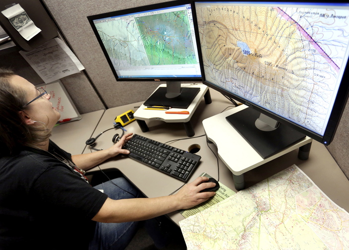
That process begins by pulling together existing map data from a variety of sources, including satellite imagery, aerial photos, U.S. Geological Survey maps, census data, military maps, public-domain commercial maps, and maps produced by foreign governments, Garrity said.
“The Soviet government was an incredible group of mapmakers,” she said.
All of the information is combined to piece together a detailed digital image of the world and all its features, both natural and manmade, creating what Garrity calls a global data set.
The accuracy and utility of that global data set is the heart of DeLorme’s value as a company, executives said. All of its products, both paper and digital, rely on it.
DeLorme’s maps have become more accurate and up-to-date as the sources of data have become more diverse. It even uses crowdsourcing as a way to update its products, Garrity said.
If customers come across a road or trail that isn’t shown on the map, they are encouraged to contact the company about it, she said.
In all, technology has taken mapmaking a long way from the old days, Garrity said.
“Old-school cartographic maps are gorgeous to look at,” she said, “but they aren’t always as accurate as they could be.”
This story was updated at 2 p.m. Monday, Oct. 21 to correct the subheadline, which had erroneously identified DeLorme’s headquarters location as Falmouth.
Send questions/comments to the editors.



Comments are no longer available on this story